|
Review by Lutz Bendlin
The GO in the US
We have already reviewed the European version of TomTom GO back in June 2004. The following article attempts
to expand on that review, and to show some of the US specific aspects of the
GO.
Coverage
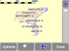
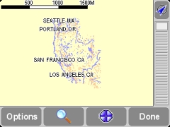
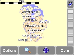
The US version of the GO we are reviewing here came with a 1GB SD card that's filled to the last
megabyte. All of the Mainland US, Alaska, Hawaii, Guam and Puerto Rico maps
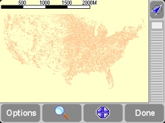
are included. The continental US coverage includes the Major Roads network
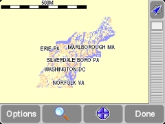
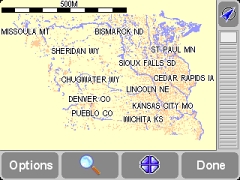
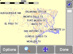
(for coast-to-coast routing) as well as six large chunks of multi-state maps.
It's important to know that the Major Roads map ionly cities, not post codes (ZIP codes).
If you plan a coast-to-coast trip you won't see this as a problem but if it's to a close by location in another map chunk then this is somewhat annoying.
The coverage of US highways is also mildly disappointing. One of the major
arteries in Houston, SH 249, is missing from the map. "These maps really need
to be updated" should be the casual greeting when TomTom employees get on the
phone with TeleAtlas
In summary, the Major Roads map really only helps you when you want to do
a coast-to-coast all on Interstates. If you are after scenic drives then you
have to use the other map chunks.
If you live on the border of two chunks you will need to switch maps manually cross map routing is still not possible (same as on TomTom Navigator). My general impression is that the maps are identical to the ones that were distributed ages ago with TomTom Navigator 2.24 for the US. The competition has a clear advantage with newer maps.
It's a consumer device
The GO has clearly been designed with the consumer in mind. You switch it
on, select the required map, get a fix, and off you go. It is easy to enter
a destination, and you can start your navigation and not touch the GO any more
until you have reached the destination.
The User Interface is consistent with the Palm and Mobile versions, and
with the upcoming version for the Pocket PC (version 4). My personal opinion
is that the TomTom rendering engine is the one on the market that has implemented
Usability guidelines to the highest degree of excellence. Type ahead features,
memory of previous entries, big finger friendly buttons, clear lines, clean
screens, friendly colors. (Interestingly enough I DO dislike the rounded corners,
but that's a very minor detail).
Be warned - the GO is not a geek device. Do not expect to be able to navigate
to a Latitude/Longitude location. Avoid areas? Nope. Route
planning options (fastest/shortest)? Not a trace. And so on. A large number
of TomTom Navigator features is missing from the GO. Some of them (like avoidance
of toll roads) will hopefully
be implemented in new versions; others (like Latitude/Longitude) may never
make it into the GO's software.
Speaking of new versions make sure to frequently check the TomTom web
site and our forums for updates at the time of writing the version 4.42 just
came out with some improvements to the management of custom POIs as well as
other enhancements.
Exploring the GO - The preferences
Preferences are very intuitive on the GO, continuing from the good foundation
of the Navigator.
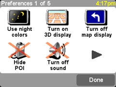 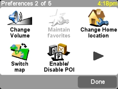
The only function that I had trouble with was the fact that the home location
is now separate from the favorites list (it was number one of the favorite
in TTN).
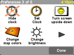
Turning the screen upside down is a nice gimmick but it does require the
active mount with external antenna connector. According to TomTom that mount
is still under development and will be available later. "Set Clock" is (in
version 4.40) adjusting your GO's clock to UTC (plus/minus), so each time you do this you
have to change the hours back to your time zone.
 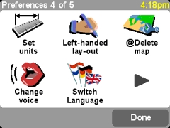
You can select the language of the voice instructions from a variety of
speakers. Later in the article we briefly touch on how to add your own voices.
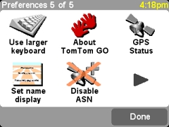
ASN is the "Assisted Satellite Navigation" feature that allows to continue
navigation for a short time after the satellite signal is lost.
POIs (Points Of Interest)
Since version 4.40 the GO supports not only the built in Points of Interest
but also custom POIs. POI groups can be selectively displayed, and can even
get enabled for proximity alerts either directly on the route or a specifiable
number of yards away. There is no need for a POIWarner or CheckPOInt add-on - this
feature is already integrated in the GO's software.
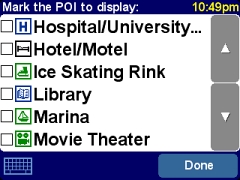 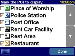
The GO has no connectivity to the outside world except for the USB connection
to the desktop, so for the time being you will need to synchronize your POIs (the OV2 and
BMP files) manually to the map directories of the GO's SD card.
Alternative routing
The GO has plenty of options to help you when your trip is not going as
planned.
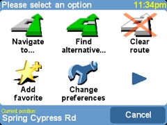 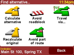
Of note is the subtle change in the base color of the dialogs from blue
to red to green, making the user understand the different severity of his or
her actions.
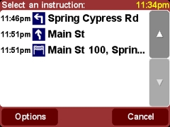 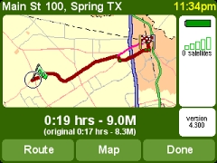
You can specifically exclude steps from the route. The GO recalculates and
shows the difference in the map (note the bright red original route) and in
the summary text (the text in brackets shows the original distance and duration,
just to let you know how much time you are losing and to make you feel bad
about your diversion). Excluding steps from a route requires a GPS signal
a minor bug.
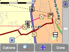
Long distance routing
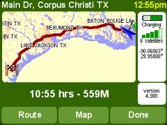
I briefly tested the routing performance for very long routes, and there
were no surprises.
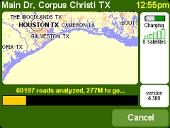 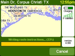
It did take a few seconds to calculate the route, but by far the longest
time is spent writing the route instructions be patient there.
The final result looks reasonable and you are good to go on this afternoon
stroll.
Mounting the GO in the Car
The suction mount that comes with the GO has an outer plastic ring that
extends beyond the suction disk. I have to call this a design flaw. Why?
Because for curved windshields like on my car this means the plastic ring is
preventing the suction disk from making sufficient contact with the glass.
This results in the suction cup falling off from certain areas of the windshield
where the curvature is too strong. Make sure you test the mount thoroughly
before you put the GO on to the mount because otherwise you may just see it
tumble down onto the floor in no time.
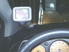 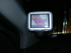
I mentioned that the GO is pretty heavy. This translates into quite some
vibrations unless you find a way to rest the mount either on the dash or somewhere
else I found a halfway satisfactory solution by squeezing the GO against
the A column of my car (Note: American car with steering wheel on the left).
That helped quite a bit to get the GO stabilized, and in passing also provides
a sufficient sky view.
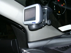
Speaking of which - the GO's antenna seems to be pretty sensitive, and is
capable of locking on to a sufficient number of satellites even when there is
no optimal skyview. Positioning the device directly on the dash or in front of
the radio should still give you the four or five sats you need for uninterrupted
signal.
The Inside
Here we go again. Time to open up - but only for me. Please do not open your GO it will void
the warranty!
One of the biggest achievements of the GO is the speaker. It simply blows
everything else on the market away. TomTom have done an amazing acoustics job
here. Lets see how they did it. .
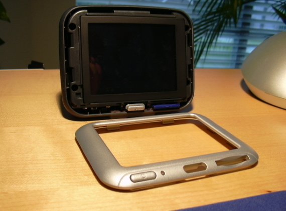
The front comes off after some fingernail work.
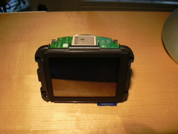
The main unit is very compact.
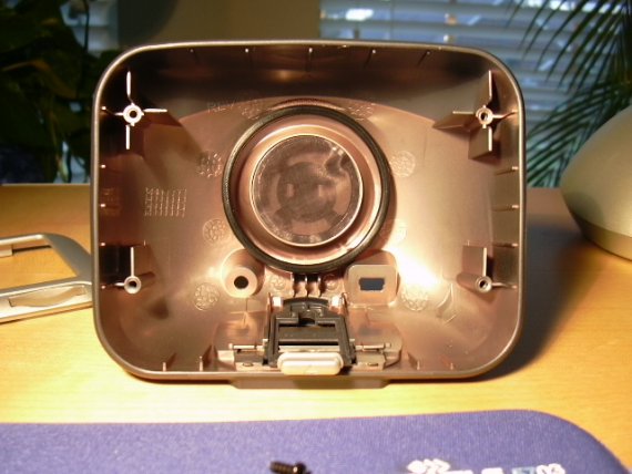
The back casing is a big contributor to the sound of the unit. Sturdy yet
flexible.
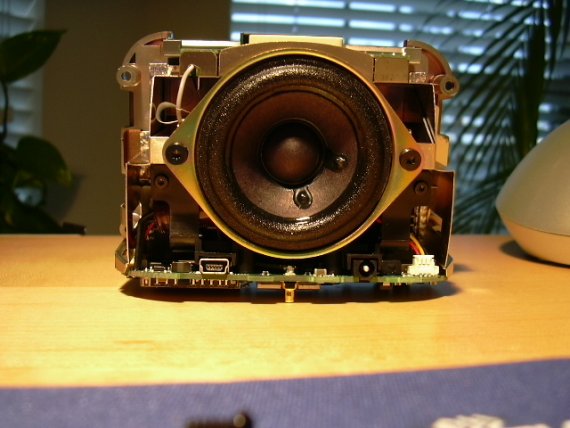
But when you turn the base unit around you see the secret behind the success
the speaker is just HUGE. Compare this to the mediocre speakers that are
used in today's Pocket PCs and powered mounts, and you know why there is such
a big difference.
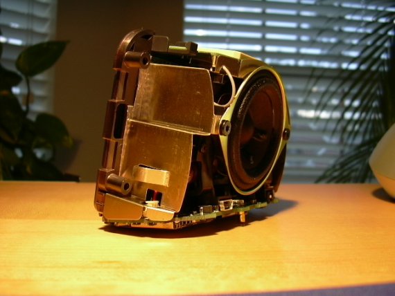
By the way, most of the weight of the GO actually comes from the speaker.
So next time you complain about the GO's considerable weight, you know it is
heavy for a (good) reason.
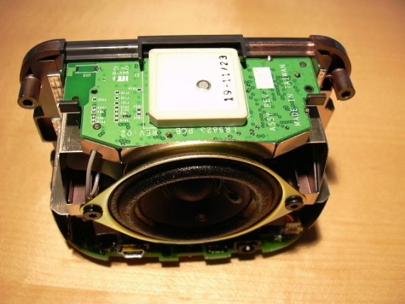
This picture shows the antenna. So where is the ASN? The "Assisted Satellite
Navigation" - a three dimensional gyroscope with no moving parts, this mystical
device that is supposed to stand in for the GPS when the satellite signals
are gone, for example in a tunnel.
Now there are not many tunnels where I live so I could not really test it.
And the parking garages don't really count
And in urban canyons it doesn't
help either there you have too many conflicting signals rather than no signal.
Anyhow, I could not find any trace of the ASN. Anyone?
Extreme GO tuning
This paragraph goes into some detail on the software of the GO please
skip it if you are not interested.
The GO is as you may or may not know based on Linux. Since that's open
source, TomTom have provided extensive information here: http://www.tomtom.com/gpl
. The site says: "TomTom GO currently uses version 2.4.18-rmk6 of the ARM
Linux kernel, with modifications by TomTom, which provide drivers for the specific
TomTom GO hardware".
Does that mean the GO software should also run easily on the iPAQ Linux?
The core
Anyhow, a closer look at the SD shows that there are three crucial files.
- system - the bootloader
- ttsystem - the Mini-Linux that also includes the TomTom Go software
- data.chk - contains all strings and the non-localized sounds (ding dong
etc)
Another pair of files contain the localized voices that you can select from
the GO's configuration menu (DATAxx.CHK), and their control files (VIF).
Last but not least you find the map directories, with pretty much the same
file structure as in the TomTom Navigator 3 version. Note: You do need to own
licenses for both versions (TomTom GO and TomTom Navigator 3) to swap maps
between them.
The voices
There is a big selection of local voices included, amongst them two female
and one male American English versions.
The voices are, true to the Linux motive, OGG Vorbis encoded and then compacted
into CHK files. Apart from that they are mostly identical to the WAV voice
files that are used by TomTom Navigator.
What this means is you can indeed influence the way the GO speaks to you.
I, for example, do not like the word "After" being spoken at every turn. So
I replaced the "after.wav" file with a nearly empty copy (completely removing
the file doesn't work).
For the GO I simply re-encoded the WAV files into OGG Vorbis format. You
can do this for example with the freely available oggenc.exe, or you may want
to use a more sophisticated program if you want to raise the volume, normalize
the sounds, or if you want to record your own voices.
Next, there is a tool available on the web ( http://ghostwheel.de/viftool.zip )
that allows you to pack the OGG files into a CHK file. The tool will also create
the required VIF file. Let me know if you need more details on this process.
If you can understand german you can also hear it directly from the author
of the tool here.
The last step is to copy the file pair onto the SD card and select the newly
created voice from the GO preferences menu.
The maps
As mentioned previously the 1 GB SD card is pretty well packed to the maximum.
If you are planning to add POIs you will have to delete something off the card.
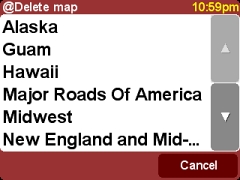

You can delete voice files that you don't need (the DATAxx.CHK files) or you
can get rid of some of the maps that you may not need (no offense, dear inhabitants
of Alaska!) either via the preferences menu or by connecting the GO to your
desktop or notebook computer and deleting the map directory from the SD card
via the "card reader" (the GO, so to speak).
If you need the deleted maps back you can copy them over from the backup you have made of
the SD card when you received the GO. You did make a backup, right?
Oddities
One of the most glaring omissions on the GO is a power save mode. If you
forget to switch it off then it will drain it's battery completely. Fortunately
this is not too big of a problem since most of the preferences are quickly
changed back to what you had before the power outage.
Another annoying omission there is no indication about the charging process
when the GO is switched off.
The front LED will be on whenever power is applied, it does not blink while
charging. To know how far the charging process has gone you will need to disconnect
the GO from the mount and look at the charge meter.
Route Planning
 In the US it is very important to be able to enter a street name before
you select the city simply because many streets in suburbia extend through
multiple cities, and you never quite know which one it is this time. Having
the choice of cities (even better: ZIP codes) and distances will then allow
you to pick the right one. With the TomTom GO it's hit and miss. You will
have to try all the cities until you find your street or intersection. In the US it is very important to be able to enter a street name before
you select the city simply because many streets in suburbia extend through
multiple cities, and you never quite know which one it is this time. Having
the choice of cities (even better: ZIP codes) and distances will then allow
you to pick the right one. With the TomTom GO it's hit and miss. You will
have to try all the cities until you find your street or intersection.
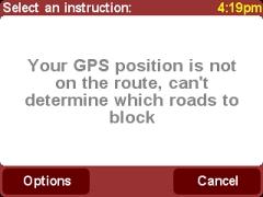
Here's another one: Say you want to plan a route ahead of the actual trip.
You sit at home, are planning the route from A to B, and you then want to block
certain parts of the calculated route.
The TomTom GO refuses to do so and instead gives you a not so subtle error
message.
E-roads
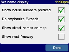 E roads are trans European roads. A highway in Germany may have a name
like A9, and another "european" name like E44. The setting to de-emphasize
E-roads will call the road A9/E44 rather than E44/A9 on the map display and
the turn instructions. E roads are trans European roads. A highway in Germany may have a name
like A9, and another "european" name like E44. The setting to de-emphasize
E-roads will call the road A9/E44 rather than E44/A9 on the map display and
the turn instructions.
Of course this is irrelevant in the US and this setting should have been omitted from
the User Interface. Simply ignore it.
Strange maps
Maps are still quite a bit of a disappointment, but this is not just limited
to the GO. TomTom have again not used the opportunity of the GO launch to deliver
new maps. Instead, the maps are exactly the same ones that were out of date
already when TomTom Navigator 2 got rolled out in the US. I would estimate
them to be from mid 2002.
Here are some of the bloopers, some funny, some outright dangerous.
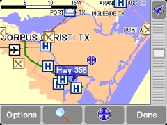
Those of you who know Corpus Christi will know what's funny about this picture.
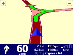 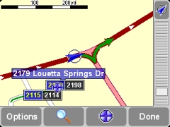
This one's just plain funny. Reminds me of a divining rod. Maybe there's
oil underneath that road
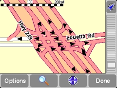
This one is not at all funny. Despite multiple requests into both TomTom
and TeleAtlas this dangerous intersection mistake (the one way arrows in the
U-Turns point in the wrong direction) is still not fixed.
Of course these map errors are not specific to the GO. You will find them
in the TomTom Navigator, and in the versions for Palm and Smartphones.
Pro's
- high optical appeal and cuteness factor
- fantastic sound
- functionality reduced to the max
- All of the US maps on the storage card
Con's
- Old maps
- No automatic standby mode
- Suction mount not suitable for curved windshields
- Too bulky to take out of the car
- Expensive
Conclusion The TomTom GO is an excellent consumer navigation device that can be used
in one or more cars. (It is of limited use outside the car because it's just
too heavy and bulky for that even though the battery can last about five
hours when fully charged). It can truly be used "out of the box" with little
to no training.
The GO does not have the complete feature set of its sibling TomTom Navigator,
but there is still a good deal of customization that you can do to it. Most
notable is the support for custom Points of Interests and the built-in proximity
alert.
The GO would be the perfect device if it had newer maps.
|