|


http://www.winpilot.com
Price
$299
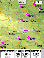
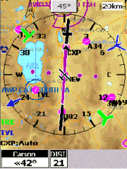
WinPilot is a unique peace of
software. It's GPS software and maps, but not from the ground.
From the air!
The name WinPilot beautifully describes the
product. It's a Windows CE based GPS program for pilots.
Enabling pilot's to navigate the sky and find where you are, where you are
coming from and where you are going to.
WinPilot currently offers maps for Europe,
USA, Australia, Bermuda, Botswana, Caymans, Canada, Japan, Mexico,
Morocco, Mozambique, Namibia, New Zealand, South Africa, Zambia, Zimbabwe.
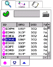
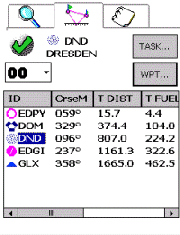
The
Browser page can be used to narrow down the list of possible waypoints to one
choice. That choice is then available both on the Flight Plan and Details page.
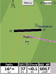
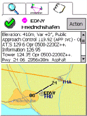
The Details page can also be invoked by touching a waypoint name on the map.
The
Flight Plan Editor page is used to manage tasks.
There are 24 possible tasks, but the one being flown is always task 00. Any task
can be copied to task 00, and task 00 can be copied to any other task index.
In task 00, WinPilot always navigates to the first waypoint on the list.
All columns on this page are user-selectable. To change a given column to
display some other king of data, touch its header.
The
Details page shows the information about the selected waypoint, and a map (with
terrain info if a terrain map is selected).
From the Action button on this page, it is possible to copy the waypoint to the
beginning of task 00 (FLY TO), or move the current position of the simulated
glider to that waypoint (JUMP TO).
WinPilot
VFR can be tested in the Simulator mode free of charge. Just download and
install the software, and start it from Start.WinPilot VFR Simulator shortcut.
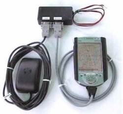
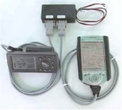
To use the program in with a GPS receiver, a license is required. The license
cost is $299, which includes free software, free database, and free map updates
until January 1st 2003.
|