|
|
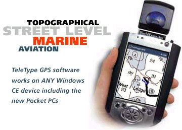
TeleType
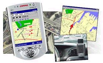
GPS software allows you to combine a Global Positioning System (GPS)
receiver with our software and maps to provide a moving map display when
you travel. The software includes street level maps for either the entire
U.S., Canada, or Europe. The proprietary compression technology
allows you to easily select and transfer small towns to big city maps, in
fact in most cases you can fit an entire state map right down to street
level directly within the handheld computer's main memory. In addition to
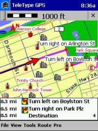
streets, TeleType GPS also displays rivers, lakes, oceans, and parks. An
average sized U.S. state uses about 15 megabytes of space on your
computer. You can choose to load entire states or just portions (the same
high quality maps) of states to your handheld device, whichever suits your
travel needs best.
|
|
TeleType GPS software is the most flexible and fully featured GPS enabled
mapping software available for Windows CE and Pocket PC. The same software
also supports desktop and laptop systems. Whether you need a completely
wireless system featuring wireless GPS receivers and software, or a budget
based system you're sure to find the solution
FEATURES
• GPS
moving map software and maps
•
Supports Windows CE, Windows
98/ME/2000/XP, Pocket PC
•
Door-to-Door Routing - extremely
fast routing on PDA's and laptops. NEW
•
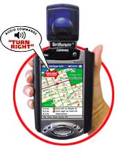
Choose Human or Synthesized
voice. NEW
•
Synthesized voice speaks street
name for upcoming turns. NEW
•
Voice and visual alerts
•
Reroute - reset your course if you get off track
•
Displays lakes and rivers
•
Highly compressed map format fits up
to six times more map area than competitors. See Map Sizes
•
Plot routes that span multiple states
•
Route using preferences such "via
highways"
•
Supports turn restrictions (knows about one-way
streets!)
•
Create your own unlimited number of waypoints
•
Store frequently used addresses & routes
•
Terra Server map support
•
World File support
•
Search by Waypoint name
•
Over 3 million points of interest - including
restaurants, hotels, ATMs, gas stations, hospitals, public &
governmental buildings, and more
•
Selectively show/hide waypoints by route (folder).
•
Search Points of Interest by name
•
Head Up or North Up moving map view
•
User definable assignment of TeleType GPS functions
such as zoom in/out to Pocket PC
buttons
•
Marine maps available for purchase via electronic
download-buy only the maps you need when you need.
•
Voice and visual alerts, customizable to city versus
highway travel.
•
RMC log file output record
•
Attachment of photos to Waypoints
•
UTM grid support
•
Easy export maps from Desktop computer to Handheld
computer (either main memory or storage card)
•
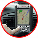
Customized navigation screens for driving, flying,
and boating, provide more area for map display, vital data appropriate for
each method of travel.
•
Worldwide tracking of position
•
Street maps and Points of Interest included (see catalog
for complete list of product offerings).
•
Import your own scanned maps
•
Distance measuring
•
Course direction
•
Automatic map loading
•
Trip route recording and replaying
•
Trip route export
•
Display layering
•
Large viewing area
•
High resolution screen
•
Ability to load a large geographic
area
•
De-cluttering zoom
•
Zoom in/out for all maps
•
Display of current position
coordinates
•
Metric/English scale units
•
Complete waypoint entry and
management
•
Easily add user waypoints
•
Touch screen display support
•
Color support for our maps and maps
that you import
•
Supports any NMEA based GPS
receiver*
•
Tracks up to 12 satellites
•
Voice alerts for turn-by-turn directions in Italian,
French, German, Dutch, and English spoken with female French accent are
available
•
Door-to-Door routing for U.S. and Europe with new
improved speed of routing, and new features such as routing "via
highway", "via ferry", creating the "Quickest
Path" or the "Shortest Path".
•
Compatible with Windows XP
•
Export map files directly to PDA
•
Supports Pocket PC 2002
•
Lifetime use of the GPS (no fees or
connection time charges)
•
Toll free technical support
|