|
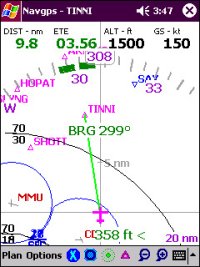
Navgps Basic is the entry level product and provides
all basic aviation navigational functionality.
Designed
from the ground-up by a pilot and with input from other professional pilots.
It's been on the market for over a year and it's user-interface and features
have repeatedly been improved through actual flight experience.
All
you need is a handheld GPS that outputs NMEA data, a cable to connect the two
and you're set. Some users have connected their in-panel b/w GPS unit to their
PDA. Most in-panel GPS receivers will output the required data.
Some
of Navgps Basic's major features are:
-
world-wide
aviation database. Navgps provides free data that contains airport,
airport-info, navaids and fixes.
-
current
aviation database can be purchased - they contain airspace data. All
warning, class-b/c/d, sua, warning and prohibited areas are displayed along
with frequencies of the controlling authority.
-
configurable
color schemes.
-
can
create your own text-based databases - add your own airport/fixes.
-
configurable
hardware-buttons {PocketPC}
The Pro
version of Navgps contains all the features of Navgps Basic, plus:
-
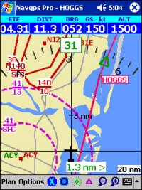
Vector-based
topographical data for the entire world. Some of the included elements are
coastlines, political boundaries, rivers, lakes, populated areas, roads and
rail-roads.
|


|