Home PageFacebookRSS News Feed
PocketGPS
Web
SatNav,GPS,Navigation
SurfShark Antivirus
PocketGPSWorld.com Event Article

Mobile World Congress 2010 : Vision in Action


Barcelona 15-18 Feb 2010 sees the MWC 2010 conference take place. I would like to say that I am reporting live from Barcelona, but due to problems with Easyjet yesterday myself and 200+ other people wont be at MWC this year? More of which later.

MWC is always an important event but this year we could be on the cusp of the supreme dominance of SmartPhones particularly in the navigation and LBS markets. The battle is on between Android, iPhone, RIM and Windows Mobile. Will this year see the rise of Android and the demise of Windows Mobile? I wish I was there to find out! Thanks Stelios!!!

However, unlike Easyjet, we do have contingencies for problems and our roving reporter treading the boulevards will be MaFt, who while I am writing this is flying on his way to Barcelona.

Keep a check on the home page for headlines and bookmark this page for more detailed MWC news as it comes in.


Created by Darren Griffin on Saturday, February 13 @ 18:33:00 UTC


Waze Add Scoreboards to Increase Mapping and Personalised Routes


Waze have updated their iPhone app to include scoreboards for the amount of mapping that people do. It allows users to compare their scores with other users in their country/state or even worldwide. The 'competition' aspect is likely to increase the amount of mapping that users do.

They have also added personalised routes. Akin to Navigon's MyRoute, the app monitors the routes you regularly take and will offer you YOUR route to work, not necessarily the shortest or fastest. You can of course choose one of the more standard routes if you wish!


Waze Scoreboard

Waze Personalised Routes


Article by Darren Griffin on Thursday, February 18 @ 09:42:09 UTC


Endomondo: Social Sports and Excersise Logging


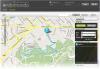
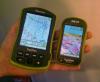
Up in App World still were Endomondo who offer a training app for various sports such as running, walking, cycling, golfing, skiing and many more. The app is available for a range of devices running Symbian, Windows Mobile, Android, iPhone and others. Once registered (for free) on their website you can create new logs recording the type of sport and the date etc. Locations are logged every 10 seconds with either instant upload to the server or you can choose to cache it and send it later - for example if you have a limited data plan.

On the website you can view all your previous tracks as well as historical data to see how (if?) you've improved and also see your friends logs. The maps can be easily shared via the likes of Twitter and Facebook.

There are a lot of supported devices for the mobile app (see their website here) and this is all free. Some of the versions of the app (iPhone, Symbian, Android) allow friends to send 'pep talk' messages that are then read out using Text to Speech to the user for example "Come on Mickey, you've been sat in Starbucks for 30 minutes, now get moving". You can also import from your Garmin device using the Garmin Communicator Plug-In or simply upload a GPX file from any other device.

The apps and website are completely free at the moment. Premium features will be made available in the future (such as personalised training regimes) but the apps and site, as they are now, will remain free - it will simply be additional features that will be paid for.


Endomondo on iPhone

Endomondo Web Map View


Article by Darren Griffin on Wednesday, February 17 @ 00:57:49 UTC


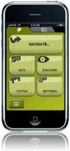
Waze Discuss iPhone App, Income Sources and Open Street Map


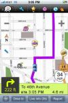
Waze were displaying their iPhone app in the App Planet area of MWC so I met up with them for a brief chat about their app, their business and their thoughts on the Open Street Map.

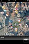
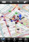
If you don't know then Waze is not only a totally crowd-sourced mapping solution, but also one that provides free Turn by Turn navigation too. Some of the 'selling' points (it's all free to the end user) are real-time traffic updates either from the app detecting you are moving slower than normal or by a user specifically sending a message saying there is traffic. There is a large social element too allowing users to send messages to others about current traffic status among other things.

In the USA the app has the publicly available TIGER data as a starting point - the idea being that users then correct, confirm or add to this. In order to bribe users to update it and perhaps go of their normal route Waze turns it into a 'PacMan' game - the software adds markers in the unmapped areas and when you drive past them you score points. It's a gimmick but it seems to work - it would be interesting to see how this works in Northern England with, I presume, very few users. I've not personally used the app yet although I have done some mapping for the Open Street Map project which has similar aims - to provide free mapping to the end user. OSM differs in that the data cannot be licensed for commercial projects whereas Waze do have a commercial side.

Waze's income is generated by selling the historic traffic data, the live traffic feed and fleet/live maps APIs to companies and organisations such as, for example, the Israeli government's traffic planners. The mapping has always and will always be free for the end user.

On the subject of OSM it is worth noting that Waze have previously asked to incorporate the OSM data into the Waze maps but owing to the OSM's non-commercial license no agreement was made. Waze do not see it as a 'competition' as such but are happy that there are other free mapping organisations as alternatives to the paid for services such as TeleAtlas and NavTeq. This lack of animosity was somewhat 'proven' when Waze informed me that they are working on an update to the iPhone app to allow users' track logs to be exported in GPX format so they can be easily added to the OSM data.


Waze iPhone App


Article by Darren Griffin on Wednesday, February 17 @ 00:05:13 UTC


woZZon: Location-Based Entertainmesnt Guide for Android Launched


woZZon (aka "What's On") have today launched an Android app in the Android Market for their UK entertainments guide. Boasting over 90,000 unique events every day at over 60,000 geo-coded venues across the UK the app covers various categories like art, film, music, theatre, comedy, restaurants and more. You can even view film trailers!

You can either enter a town name or the app can locate you automatically and provide local listings. You can also search for a specific event too. It is free to download and available in the Android Market now - they also have an iPhone app and the website, wozzon.com, is mobile friendly.


Article by Darren Griffin on Tuesday, February 16 @ 23:22:31 UTC


Navigon for Android on Display and iPhone App v1.5 on Show


The Android version of Navigon's popular Mobile Navigator has been on show here at MWC. The Android version will be playing catchup with the iPhone version so the initial release for Android is essentially the same as the iPhone's initial release. Other features, such as Text to Speech, will be added in later updates and, like the iPhone version, some features will be chargeable add-ons such as the traffic and panorama view.

The iPhone version will soon be updated to v1.5 which will add Panorama View (paid for add on), Twitter and Facebook integration to post your location and MyRoutes (which gives alternative routes based on your driving style).


Navigon on Android

Panorama View on the upcomging iPhone app update


Article by Darren Griffin on Tuesday, February 16 @ 18:05:01 UTC


Telmap 5 Brings More Features and More Adverts


The latest release of Telmap, version 5, is coming soon. Featuring a new location-based advertising engine (powered by 4th Screen and NavTeq in the UK), social networking and widgets.

The widgets can be anything from live weather to carrier-decided branded POI sets such as Starbucks or McDonalds. These would be fed directly from the service provider giving the carrier complete control over which POI sets you can use. The Twitter widget will show local tweets and allow you to reply but it is not a full-blown Twitter client.

The app should be available in the coming months with Israel and the UK planned on being the first releases.


Telmap 5 Logo

Telmap 5 - In Use (With Widgets)


Article by Darren Griffin on Tuesday, February 16 @ 17:36:11 UTC


NDrive to Make a Shift Towards OEM


NDrive have officially stated they will be leaving the direct hardware business and shifting their focus more toward the OEM market - be it for mobile devices or PND's.

They have also just launched their latest NDrive navigation software, NDrive V10. Unfortunately they had no press kits left and didn't seem to enthralled at explaining to the press what was new... So, there you have it, NDrive is updated and... erm... apparently it's improved...!


Article by Darren Griffin on Tuesday, February 16 @ 17:27:35 UTC


Wild Knowledge Display Range of GPS-Enabled Educational Tools


Wild Knowledge, a UK company, have been displaying their unique teaching aids. Primarily targeting the UK education sector they aim to go against the assumption that mobile phones in school are bad. They have 4 apps available at present, 3 of which utilise GPS. They are all web-based so work well cross-platform but they are also developing a native iPhone app.

Wild Form is a survey tool whereby students and teachers can create a form in the class room, for example to log the different types of shops in a high street. Then they students go out armed with PDA's or smart phones and do their geography lesson. One bonus of this method is the students have to go to a location as they would usually need to provide a geo-tagged photo as evidence. The results are then either uploaded over the air or cached for uploading over WiFi. Results can include any information they require (it is set up in the form beforehand) along with GPS locations so they can be plotted on a map later.

Wild Map is used to create tours or trails with specific content added into the route such as location tagged videos - for example this could be used on a tour around a historic local park with video clips at relevent points.

Wild Key is a decision tree that allows for the identification of various things such as wild birds etc. Users can then log the coordinates of their find and these can be pooled together back in the class room for a map of all their finds. Each of the data-sets can then, for example, be shared between schools across the country.

I wish my geography field trip to Skipton had been this engaging...!


Article by Darren Griffin on Tuesday, February 16 @ 17:24:38 UTC


Toshiba to Release the K01 With NDrive Navigation


Toshiba have on show their new K01 Smart Phone which will ship (dependent on carrier) with NDrive's navigation software. It will likely be running Windows Mobile 6.5.3 (although this is not yet confirmed) and features a massive 4.1 inch OLED screen. It has a hardware, slide-out keyboard and still manages to come in at only 12.9mm depth. There are no set release dates yet.


Toshiba K01


Article by Darren Griffin on Tuesday, February 16 @ 17:08:02 UTC


Nokia Believe Free Mapping is a Very Sustainable Business and Use You to Update Them


I had a meeting with Nokia today about their OVI Maps and how sustainable it is as a business method. They have now reached over 3 million downloads and registrations of OVI Maps since their recent launch of the totally free version. We were concerned that perhaps the free mapping 'giveaway' would reduce the quality of NavTeq's data as their would be increased usage but reduced income but Nokia were keen to state that it is only free to the end-user and there was an 'internal accounting exercise' involved - in other words Nokia essentially pay NavTeq for their maps anyway.

Also regarding map development, Nokia stated that the OVI Maps app will record all your journeys (anonymously) and feed this back to NavTeq who will then use the data for map corrections and updates - much like TomTom did with their IQ Routes data harvesting. You can, of course, opt out of this from within the app.


Article by Darren Griffin on Tuesday, February 16 @ 17:03:39 UTC


Broadcom: Hybrid Positioning Service, $3 GPS chipset and Android-based Multi-use Tablet


Broadcom have been displaying their Hybrid Positioning Service that allows a users location to be determined even when indoors. This uses a mixture of WiFi signal strength (against a regularly updated database of access points), cell triangulation and Cell ID. Each use is specifically designed for a particular device depending on the phone's built in hardware.

Also on show was tie latest GPS chipset, the BCM4751. This is very small, has a very low power consumption and is very low cost - a system cost of only $3. It can use GPS signals as well as Japans QZSS system launched later this year. Augmented systems such as WAAS (USA), EGNOS (Europe) and MSAS (Japan / Australasia) are also supported. The BCM4751 is already in use in some Android, Motorola and Samsung phones owing to it's small size and low power consumption.

And, finally, for Broadcom's GPS-related offerings they had on show a development system known as the 'Persona Platform'. These are Android-powered tablet devices that can integrate live video feeds, be used with DLNA to control compatible TV's, store video's locally and, as they have an integrated GPS chipset, they could be used as large-screen navigation devices when fit to a suitable dock.


Article by Darren Griffin on Tuesday, February 16 @ 16:54:19 UTC


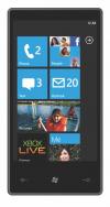
Windows Mobile is dead, long live Windows Phone 7


Nearly 3 years after the launch of the iPhone Microsoft seems to have suddenly woken up and realised that the World has changed, and today they effectively killed Windows Mobile and introduced in it place Windows Phone.

WP7 will require a new dedicated hardware platform with Start, Search and Bing hardware buttons. The interface is a tile based UI, which on first sight looks a little simplistic. Integrated into the OS are music, images and video from the Zune platform and also XBox live. The OS integrates with Enterprise applications such as calendar, contacts and email. I am also assuming that the hardware must have capacitive screens as it implements multi-touch gestures in a similar manner to the iPhone.

From the look of the presentation the LBS features are integrated well mainly based around Bing maps and search.

The system is based around integrated experiences consolidating various data sources into contextual categories which Microsoft call hubs. For instance "People" presents most recent contacted people wether by text, phone email etc… It also consolidates phone book, email accounts, exchange contacts, Windows Live, facebook etc. Other hubs include Pictures, Office,

It looks like Microsoft has indeed recognised the fact that it was lagging behind and has thrown out the old OS completely and has a refreshing fresh integrated OS. Unfortunately Windows Phone 7 will not be available in the shops until just before Christmas which sort of leaves a huge hole in the OS lineup in the run-up to the release.


Windows Phone 7
Windows Phone 7

Windows Phone 7 people hub

Windows Phone 7 office hub

Windows Phone 7 call


Article by Mike Barrett on Tuesday, February 16 @ 11:14:48 UTC


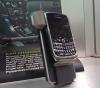
Powermat Goes Global - Wireless Charging For All!


OK, this isn't specifically GPS or LBS related but there IS a link... How many of you have a selection of gadgets (dataloggers, bluetooth GPS receivers, SatNavs, smart phones, dumb phones, iPhones, media players etc etc etc) and a separate charger for each? Well, Powermat aim to reduce that by providing a wireless connection to charge your devices. They have also aimed to expand their business by one global market per month in 2010. Pretty ambitious if you ask me but one that I can see them managing to fulfill.

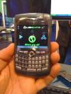
If you haven't seen these then basically they comprise of a Powermat (charging station) and some kind of adapted device to allow it to get charged by the Powermat. The adaptation, initially, was an external case for the iPhone or a new backing for some of the Blackberry devices. They have since added a huge range of products to their line so you can charge digital cameras, smart phones, Sony PSP, Nintendo DS, iPod etc. Some of these require the Powercube which contains various adapters to plug into your device (so not really wireless anymore but at least it means less chargers to carry with you!).

Some of their more recent additions have been replacement batteries for devices which allow you to use the Powermat. Some, such as the HTC Hero, also require a slightly modified battery cover but these are included with the replacement battery. What is, perhaps, one of the more interesting announcements is Powermat's OEM program. This allows 3rd parties to create devices that will work with the Powermat such as kettles, phones, camcorder batteries etc. We are used to seeing 'Works with iPhone' on many peripherals, perhaps soon we will start seeing 'Works with Powermat' on more and more electronic devices. They have also developed car charging kits using the Powermat system.

Powermat products are already available in the UK at John Lewis and Amazon among others) but some new products such as a single-device Powermat bundled with an iPhone case will be available in a wider range of high street stores.


Powermat - mutiple devices

Powermat - car kit

Powermat - camcorder battery


Article by Darren Griffin on Monday, February 15 @ 23:50:00 UTC


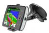
Teleatlas 'Just Fancied Being Different' and Also Talk About ADAS


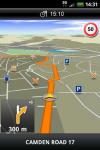
TeleAtlas usually have quite a large stand at events such as MWC and CeBIT which generally feature their partner companies showing off how they use TeleAtlas data. This year, however, there is have no stand and their only presence is a 'hospitality booth' - this resulted in a little bit of speculation that perhaps TomTom (who have zero presence here) and TeleAtlas did not see the mobile market as having any significance.

One interview later and the official statement is that TeleAtlas that the mobile market is very significant and has, possibly, the most potential at the moment. They stated, too, that 'TomTom also have their iPhone App'- but nothing else was mentioned about TomTom and the mobile market.

With regards to the Nokia OviMaps being given away free TeleAtlas did not see this as a major issue. They are only 'free' to the end users - 3rd party's could always pay TeleAtlas for their map license and give away the resulting software or device for free...

And, finally, we chatted about their ADAS (Advanced Driver Assistance System). Put simply this uses the TomTom device data (the 'anonymous usage statistics') to add extra information to the map data such as hill gradients, traffic flow patterns (e.g. the average speed may be 25mph but ADAS can also log if it is stop-start or smooth flowing). This can initially be used to monitor fuel economy (eg a steep uphill would use more fuel than a level road) and give alerts to the possibility of stop-start traffic on a motorway. Further down the line they envisage the system suggesting the safest speed for a particular corner and even as far as matching it to historic weather reports too - for example on a wet day the average speed for a sharp corner was 20mph so the system suggests you travel at that speed as a maximum.

The ADAS could also be used in a vehicle without any navigation - simply for the safety aspect of speeds on corners and hills as well as fuel economy.


TeleAtlas


Article by Darren Griffin on Monday, February 15 @ 18:03:26 UTC


Garmin Display Their Latest nuvifones - A50 and M10.


Garmin are displaying their latest nuvifone models the A50 (Android) and M10 (Windows Mobile). Both devices are very slick and actually very nice to use. Unfortunately thanks to Easy Jet we're unable to post any video of them so you will need to take my word for it...! However we plan to get some video footage once the Garmin team return to the UK!

The A50 runs Android 1.6 (Cupcake) but has been heavily modified to add a lot of the features from 2.0 (Eclair). The devices themselves look and feel very good; the A50 is pretty much the same size as an iPhone but slightly lighter, the M10 is a little narrower but also thicker. The A50 also introduces the first capacitive touch screen on a Garmin device.

All the features are very tightly integrated be it sending an SMS and attaching your location, or navigating to one of your contacts. Personally it looks like a very good balance between a navigation device and a smart phone. They include many of the nuLink features such as Google search, Ciao, Weather, Flight status and fuel prices. The A50 also has a 3MP autofocus camera and the M10 a 5MP fixed-focus camera. The A50 has 4GB inbuilt flash memory and is expandable using micro-SD. With a direct link to the Android Market the A50 could certainly put up a good fight with the iPhone.

Pricing will depend entirely on the carrier(s) and any subsidisation - at the moment only O2-Germany has been announced as one of the carriers. Garmin have no firm plans to limit the devices to a single carrier. It is hoped that the A50 will be available in shops by the end of June (this year!).


Garmin-Asus nuvifone A50

Garmin-Asus nuvifone A50

Garmin-Asus nuvifone A50

Garmin-Asus nuvifone M10


Article by Darren Griffin on Monday, February 15 @ 16:39:58 UTC


Compe GPS Launch Sportiva Hand Held, Outdoors GPS and iPhone / Symbian Apps


Compe GPS, who last year launched the TwoNav Aventura GPS, have just released their smaller and lighter Sportiva hand held outdoors GPS. It is the lightest device in it's category and, like it's bigger brother, is 'weather proof' with an IPX6 rating. Aimed solely at the outdoor walking market it has no internal speaker for voice navigation. The device is made by Holux and customised with Compe GPS's software. You can install maps from various sources (one of their selling points is the software's openness to multiple map types) and it has a 3D digital compass (i.e. it doesn't need to be held flat) for automatic map orientation. 3D terrains are shown on the device too. They claim 10 hours of 'normal' use which, when questioned, means dimmed screen brightness and and checking it every so often. You would get around 5 hours on full brightness and with the screen always on. It costs €379.

They also showed their iPhone and Symbian TwoNav app that uses the same software as the Aventura and Sportiva. The iPhone app makes use of the data connection and maps are off-board - it will cache the maps and in the app you can set how much space to use for this. The Symbian version requires you to buy maps separately but these are on board. It is available in the AppStore for €49 and the Symbian version is €59 but the maps are not included.


Compe GPS Sportiva

Aventura next to the new Sportiva

iPhone App


Article by Darren Griffin on Monday, February 15 @ 16:24:55 UTC


Navigon launch MobileNavigator for Android


As expected Navigon have announced Android support for the MobileNavigator application. We recently did a comparison of the iPhone offerings and found the Navigon Mobile Navigator to be the best available at the time. At CES Navigon announced Android and WM versions, so it was not a big surprise that they announced it over here in Europe as well.

From the press release it is not clear which version of the software will be available, one would assume the equivalent of the iPhone 1.4. It is also not clear on exactly what features will be included as standard and what (or if) additional add-ins will be available. More may come to light when MaFt visits Navigon tomorrow.

They are offering it on the Android Marketplace for €49.95 (Germany Austria and Switzerland) or €74.95 for a full Europe version. There is also an option of 30 days free trial of the full product software.

More details here.


Navigon MobileNavigator for Android

Navigon MobileNavigator for Android


Article by Mike Barrett on Monday, February 15 @ 15:53:37 UTC


Augmented reality meets facial recognition: New app from Comverse and Face.com


Have you ever had that embarrassing feeling of recognising someone but not remembering their name? Well, in the future that could all be a thing of the past. Comverse are releasing an application that integrates with social network contacts. The app has the potential to connect people before they even know each other’s names. If you bump into someone who you met before and he or she looks familiar but you can’t remember why, the app will locate that person’s online profile to put a name to the face.

“Augmented reality was the first step to bridging the gap between on- and off-line worlds; now our technology takes it further,” said Gil Hirsch, CEO, Face.com. “The Comverse app, utilizing Face.com facial recognition technology, closes the loop by merging face-to-face with virtual social communication.”


Article by Mike Barrett on Monday, February 15 @ 13:44:51 UTC


Nav N Go: Android and iPhone News


Well, firstly, Nav N Go's iGO MyWay for iPhone is soon to be updated. Version 1.2 is currently awaiting Apple's review process and will feature Text to Speech as well as the latest map updates.

On the Android-front Nav N Go are still sticking to their roots as a 'white label' company. There are no plans yet to release an iGO branded version of their navigation software for Android. One issue they face is that Google do not allow Hungarian (and other Eastern European countries) to sell in the Android Market. SO unless they shift their offices to Paris or Google change their policies then this might never even happen. All is not lost, however, as the Samsung Omnia II (Hungarian edition) comes pre-loaded with the iGO navigation software. It comes with a 60 day free trial and then a full license can be purchased from Naviextras.com. Motorola have also got in on the game but not just for Hungarian devices. Any Motorola 'Motonav' phone, such as the Motorola Milestone, use Nav N Go's navigation solution, albeit branded for Motorola.

They have also just launched a new navigation software version for PND's - iGO PRIMO will be showcased at CeBIT in March but features driver alerts that replicate traffic warning signs, realistic junction imagery and can also be used specifically for HGV navigation.


Nav N Go iGO on the Samsung Omnia II


Article by Darren Griffin on Monday, February 15 @ 13:13:40 UTC


UbiEst Display UbiSafe Tracker and UbiNav Off-Board Navigation


UbiSafe is a general GPS tracking setup. Designed for tracking a range of subjects: children, cars, pets or the elderly. It is comprised of the UbiSafe 'box' (GPS receiver and mobile network SIM card), a Java app (demonstrated here on a Blackberry) and the web service. Both the app and the website allow you to set up specific alarms such as when your 'target' leaves a specific area (geofencing), goes over a certain speed or turns on/off the device - you can be sent an SMS message or an email giving the location and details. You can also track them in real time on the mobile device or on the website. The mobile app also allows you to see your location in relation to your target to help with finding your lost Grandma in the center of London! Multiple devices can be set up for tracing so if you have a handful of children you want to track then this can easily be done - it also features a handy 'locate all' function to quickly map out all your targets rather than having to view each of them one-by-one. It retails at €99 for the 'box' and €100 for the first year which covers the Mobile SIM card for sending the location updates etc. After the first year the price drops to around €70. UbiSafe is available worldwide and roaming capabilities will differ depending on mobile network carrier.

UbiNav is UbiEst's off-board navigation product. It is Java-based and features 2D and 3D mapping, auto-zoom, day and night mode, NavTeq POIs and traffic data.


UbiSafe

UbiSafe: Where Are All


Article by Darren Griffin on Monday, February 15 @ 12:55:16 UTC


Free Barcelona City Picture map from nDrive


In a move similar to that for CES nDrive have released a free iPhone app for Barcelona. If you need to find your way around and fancy trying a new navigation experience grab a download from the iTunes AppStore.

nDrive are on booth 7C70 in the Mobile world Congress App Planet section. www.ndriveweb.com


nDrive Barcelona
nDrive Barcelona


Article by Mike Barrett on Monday, February 15 @ 12:46:24 UTC


Sygic are the first European navigation app on the Windows Mobile Marketplace


At MWC today Sygic announced that they are the first European company to introduce a Turn-by-Turn navigation application into the Windows Mobile Marketplace. Although the application had been available on the Sygic website for some time it is now available on the Microsoft site as well priced at £69.19. Click here for the WM Marketplace site.

For visitors from other countries the application will be available on the regional Marketplaces shortly.


Sygic WM Marketplace


Article by Mike Barrett on Monday, February 15 @ 12:37:08 UTC


Atlas CT Display City Cruiser - Off-Board Navigation


Israeli company, Atlas Cartographic Technologies Ltd (Atlas CT), have been displaying their City Cruiser turn by turn navigation app. The app is Java-based and already has 250,000 users since it was soft-launched, for free, at getjar.com. They're now happy with the rather large beta testing and it is now being launched as a paid-for service. In the UK the mapping is provided by NavTeq and has both 2D and 3D views using either the 'normal' map or satellite view. City Cruiser features voice directions and an apparently very clever search engine to find your destination. You can also send your location via Twitter, SMS or MMS and new features such as 'navigate to contacts' are being added soon. Users are given a 30 day free trial after which it costs $2.90 per month.


Atlas CT Ciry Cruiser


Article by Darren Griffin on Monday, February 15 @ 12:36:46 UTC


Wikitude Augmented Reality app wins Navteq LBS Awards


The Navteq LBS Challenge has been won this year by Mobilizy with Wikitude an Augmented reality application for Android and iPhone. Runners-up were Mobitee with a GPS golf assistant and M2Mobi with Nulaz a geo-aware social networking application.

Back in September last year we featured a new article about the Wikitude application here with a video in action.

Nulaz is also a name we have heard of before when they were winners of an LBS Innovations award at MWC 2009.

Congratulations to all the winners.


Wikitude
Wikitude

Mobitee
Mobitee

Nulaz
Nulaz


Article by Mike Barrett on Monday, February 15 @ 12:05:07 UTC


Arrival!


After a relatively painless Easy Jet flight (complete opposite to Mike's horrendous ordeal the other day) and a rather lengthy queue at the Press Registration area I am now in the halls of 2010's Mobile World Congress!

I'm just compiling a list of people to see and will head out soon to see if I can get my hands on the new nuvifone from Garmin-Asus, see what wireless charging options Powermat have on offer or maybe just see if there are any new Brodit mounts kicking about.

I might be by myself but I'll be doing my utmost to keep you all up to date!


Article by Darren Griffin on Monday, February 15 @ 09:56:21 UTC


Easyjet spoil MWC for hundreds of techies.


In an ideal world everything would go to plan and work smoothly. In the real world things are somewhat different. Things can and will go wrong! It is a testament to the procedures and customer care of companies how things are handled when they do go wrong. I had a very sharp object lesson on how not to implement Customer Services Policies yesterday from Easyjet. This is not only an example of how important Customer Services are but also the knock on effect of a 'small' problem can ripple through the lives and livelihoods of those affected.

After arriving on-time a "systems error" stopped Easyjet checking passengers in. They checked us in, boarded us after a delay then cancelled the flight. So 8 hours after arriving at Gatwick, with not one Easyjet person having been seen, we were just dumped in the airport with zero assistance from Easyjet. There were hundreds of people trying to rebook flights on laptops and iPhones. Easyjet had nothing to Barcelona until Wednesday (the day I was scheduled to return). No other direct flights were available. We were told by a Menzies official that Easyjet were an online company and we had to rebook online.

What I also heard were stories of people from GSMA who are organising the event couldn't get there, people who had paid thousands of pounds to exhibit couldn't get there, people who had paid 2,500 euros for the conference couldn't get there, and of course at least 10 journalists sitting on the plane tweeting who couldn't get there.

Possibly worse than that though were the scenes of people returning to Barcelona and other places not understanding what was going on, not speaking the language. There was one girl in tears because she had nowhere to stay and didn't know how to get home to Spain.

Through all of this there was no sight nor sign of anyone from Easyjet, and we all know full well that they had at least 9 senior pilots and crew there. Not that this is their job, but it would have been nice if one or more of them had tried to help.

Way to go Easyjet!!!

Click here for the full story of the debacle.


Easyjet fail to get us to MWC


Article by Mike Barrett on Monday, February 15 @ 00:08:21 UTC


Comments
Posted by pppetros on Sun Feb 14, 2010 8:54 pm Reply with quote

Good!! Thumbs Up


Posted by DennisN on Sun Feb 14, 2010 10:39 pm Reply with quote

MikeB Wrote:
However, unlike Easyjet, we do have contingencies for problems


Huh! Three days ago, I received a series of three emails from them, cancelling my flights to and from Corfu this summer "due to unforeseen problems" and offering me either a full refund or free transfer to another flight within 30 days of the original. With my accommodation already booked and paid for in advance, you may imagine I rather panicked and started doing the headless chicken thing. The three emails came at regular intervals leading up to 7:49pm and by the time I found a phone number for Easyjet, I found that they close at 8pm and it was already 8:10pm.

Almost four hours later, at 11:45pm started another series of three emails arriving over the next half hour saying sorry, the earlier emails were a technical error and the flights weren't cancelled, just changed from daytime to night-time.

PS you could've sent me, I've never been to Barcelona.


Dennis

If it tastes good - it's fattening.

Two of them are obesiting!!

 
Posted by MaFt on Sun Feb 14, 2010 11:18 pm Reply with quote

DennisN Wrote:
PS you could've sent me, I've never been to Barcelona.


me neither, so tough!

MaFt


Posted by DennisN on Sun Feb 14, 2010 11:22 pm Reply with quote

MaFt Wrote:
DennisN Wrote:
PS you could've sent me, I've never been to Barcelona.

me neither, so tough!

MaFt

As soon as I'd posted that I thought maft will surely post that they wondered about sending me, but decided to send somebody competent instead. So I got off lightly!


Dennis

If it tastes good - it's fattening.

Two of them are obesiting!!

 
Reply to topic


Make a Donation


CamerAlert Database

Click here for the PocketGPSWorld.com Speed Camera Database

Download Speed Camera Database
22.034 (27 Mar 24)


WORLDWIDE SPEED CAMERA SPOTTERS WANTED!

Click here to submit camera positions to the PocketGPSWorld.com Speed Camera Database


12mth Subscriber memberships awarded every week for verified new camera reports!

Submit Speed Camera Locations Now


CamerAlert Apps


iOS QR Code


Android QR Code


© Terms & Privacy


GPS Shopping