Article by Dave Burrows
Magellan is a well known series of handheld GPS Receivers, many people ask if it's possible to load a particular map to a Magellan Handheld GPS. The answer to this is YES, but you cannot load just any old map that you have scanned, you have to purchase and upload various Magellan based product maps. Below is a sample of mapping and cartography products that Magellan make available for their Handheld GPS Receivers.
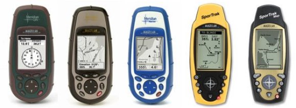
Please note that not all Magellan Handheld GPS Receivers support the uploading of maps. Please check with Magellan, or in our forums first prior to purchasing maps for your Handheld GPS Receiver.
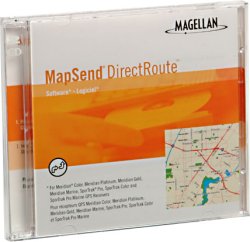
MapSend DirectRoute add automated street routing with turn-by-turn directions to your Magellan ® GPS handheld receiver!
Magellan MapSend ® DirectRoute TM is a major advance in mapping software, guiding you to your destination by adding detailed street maps, automated street routing, turn-by turn visual guidance and audio prompts to the Magellan GPS handheld receiver you currently enjoy for outdoor recreational adventures.
Now you can use automated street routing to navigate to your destination, go exploring, mark waypoints and track points in the outdoors and find your way home all on a single Magellan GPS handheld receiver.
MapSend DirectRoute makes getting where you're going even easier using your Magellan Meridian ® Color, Meridian Platinum, Meridian Gold, or Meridian Marine, SporTrak ® Color, SporTrak Pro, or SporTrak Pro Marine GPS handheld receiver.
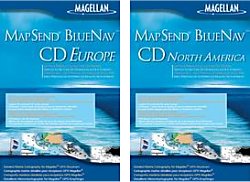
MapSend BlueNav Europe includes 191 local European navigational charts, offering a complete range of detailed marine cartography for your Magellan ® Meridian TM Gold, Marine, Platinum and Color or Magellan SporTrak Pro , SporTrak Pro Marine and SporTrak Color. Derived from Navionics ® Gold TM charts, MapSend BlueNav charts are the most advanced marine cartography available, providing large, highly detailed coverage areas and enhanced marine navigation information, including marine currents, tides, port services and much more. MapSend BlueNav North America includes 83 local North America navigational charts, offering a complete range of detailed marine cartography

MapSend WorldWide Basemap software enables you to create a basemap for any region of the world and upload it to your mapping Magellan ® GPS receiver. Adding WorldWide basemaps to your Magellan GPS receiver does not erase your built-in basemap -- it enables you to add basic reference map coverage for areas not covered by the built-in map. New basemaps can be loaded and saved via a PC to GPS cable from your PC to your Magellan Meridian ® series handheld (requires an optional Secure Digital (SD) memory card), directly to the SD card using a card reader/writer, or directly to the memory of your Magellan SporTrak ® Pro, SporTrak Pro Marine, SporTrak Map, SporTrak Color or MAP 330 GPS receiver.
Each basemap region you define contains the essential basic map features such as cities, highways, waterways, railroads, national boundaries and shorelines. WorldWide Basemap also includes basic topography contours, which can help you stay oriented to your environment and find Points of Interest.
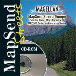
MapSend Streets offers detailed street-level maps of Europe make GPS navigation in the region even easier with your Magellan ® Meridian ® series, SporTrak ® Pro, SporTrak Pro Marine, SporTrak Map, SporTrak Color, or MAP 330 handheld receiver.
MapSend ® Streets Europe contains highly-detailed maps that can be easily downloaded from your PC to your handheld GPS receiver for a fun and simple way to navigate.
Create your own waypoints and routes on your PC, edit and download them to your GPS receiver for use on your adventure. Save thousands of routes on your PC for recording your every journey.
MapSend Streets comes in a variety of formats including a MapSend Streets Europe, MapSend Streets & Destinations Canada, and MapSend Streets & Destinations US.
DataSend Europe - Create your own personal charts. The unique DataSend TM Europe software allows you to download your routes and waypoints from your GPS receiver to your PC, to easily record your journeys and edited them for future use on a new adventure. For use with your Magellan SporTrak, GPS 315, GPS 320 or SP24 receiver.
FREE Nautical Waypoint databases
Take advantage of FREE regional nautical waypoint databases*. Download waypoint coordinates for harbors, lighthouses and more, then edit and add your own waypoints to create personal charts on your PC. Download these .zip files and open and edit the waypoint database files with Personal Mapping System Waypoints & Routes.
DataSend (US) -
contains coordinates for more than 500,000 points of interest, including harbors, lighthouses, wineries, museums, parks, campgrounds, hunting and fishing spots,restaurants and much, much more.
MapSend Topo (US)- The most advanced GPS topographic software available, Magellan ® MapSend ® Topo In the US maximizes the navigation capabilities of your Meridian ® series, SporTrak ® Pro, SporTrak Pro Marine, SporTrak Map, MAP 330 or MAP 330M handheld receiver.
The MapSend Topo in the United States software contains highly-detailed 3D topographic maps that can be easily downloaded from your PC to your handheld GPS receiver for a fun and simple way to navigate.
Map details include streets, lakes, rivers, coastlines, parks, railways and points of interest for the entire United States. You choose the regions and level of detail to download for maximum memory efficiency. The data can then be updated or overwritten with new map regions. Topography derived from the U.S. Government Digital Elevation Model (DEM), provides elevation details for every location on the map.
|


