Review by Lutz Bendlin
 Introduction Introduction
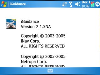
iNav Corporation have asked us to review their newly released navigation solution "iNav iGuidance 2.1.3 " for PC and PocketPC. The underlying engine of iNav is the same as we have seen on Deluo Routis and a number of other programs for Europe and North America. They are all based on Netropa code but then add some of their own special features.
As I have stated in my Deluo Routis review this is a very nice entry level application with some rather unique feature that cannot even be found in the more powerful packages.
In this review I will focus on the specifics of the new version 2.1.3 NA (North America) of iNav. If you want to have a general overview of the Netropa engine please refer to the Deluo Routis review.
What's in the box
iNav iGuidance now comes on one DVD (previous versions were delivered on two CDs). Given that most contemporary computers are equipped with a DVD drive that shouldn't be a problem for you. It certainly is more convenient to run off one DVD than to have juggle CDs around all the time.
Further we have a booklet with a quick start introduction and installation guide.
If your DVD contains a previous version (2.1.1 or 2.1.2) then you can actually download the 2.1.3 upgrade from the iNav web site. Definitely do that since it fixes a number of issues and also makes iNav WM5 compatible.
Program Installation
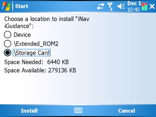
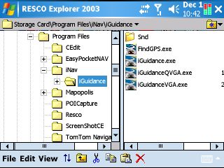
iNav installs happily to either main memory or storage card. Version 2.1.3 also fixes a bug in previous versions (the program expected its files to be in the (\Storage Card)\iNav iGuidance folder which contradicted the Windows install location). Now you can install the program to any place on the Pocket PC - as always I recommend to install it to storage card to save RAM (or WM5 flash ROM) and to have a quicker recovery from crashes and (pre-WM5) data losses due to empty batteries.
The sounds are still WAV files. Therefore you won't hear spoken street names, but the program will actually say some of the street numbers. And you can tinker with the sounds and replace them with your own creations which is always nice if you don't like the supplied announcements.
Map installation
Thankfully the excellent map selection options of the older program versions have been rescued from the attempts at "simplification" that came along with the availability of larger storage cards. iNav doesn't aim to occupy all your storage memory - unless you want it to.
You can cut maps on the desktop, selecting states/provinces or parts thereof, or picking a city and drawing a circle around it that can be anything from 25 to 150 miles in radius.
Once the map is produced (which can take a while depending on how many states you selected) you can transfer it to the device via ActiveSync (which we absolutely recommend against), via storage card reader or you can actually decide to save it to the c: drive. That way you can use the same map on the PC and the Pocket PC.
Note: You can still only use one map set at a time. To switch maps you need to rename the map folders when the program is inactive, for example rename "Maps" to "Maps California" and then rename "Maps Texas" to "Maps".
Using the program
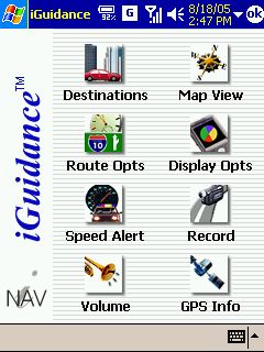
Like the other Netropa clones iNav is pretty intuitive to use, and you will be able very quickly to start navigating, even when you haven't looked at the user guide.
There are still some design oddities (Sometimes buttons are flat with a pictogram, sometimes they are 3D with text) but these are really minor and do not affect the overall functionality.
Startup time
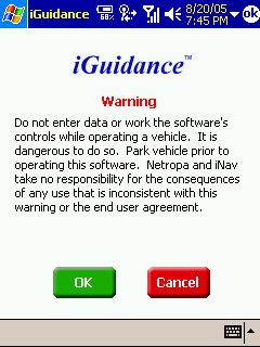
iNav is one of the fastest programs on startup. Where TomTom thinks about starting for a good twenty seconds iNav is ready to go within two seconds. It does however present the legal screen to you on every start, and there is no way to switch that off.
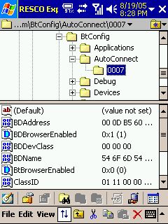 BT Browser Annoyance BT Browser Annoyance
iGuidance have introduced a bug into the new version, supposedly to "make configuration easier". At each program start the registry value "BTBrowserEnabled" will be set to 1, forcing you to select your BT receiver again (and again), even if you have only one device.
That is unfortunate (some may call it outrageous), and it is also very ignorant with regard to other programs that use Bluetooth on your Pocket PC. It is comparable to TomTom's failed attempts to hijack the Bluetooth stack with their 3.0x GPS drivers.
Luckily this doesn't affect WM5 devices (those use the MS BT stack) and for all the others there is something you can do about it, but it requires some chirurgical knowledge...
For advanced users only! Open the executable in a HEX editor, search for the Unicode string "BTBrowserEnabled" and change it to something else, for example "BDBrowserEnabled". (If you didn't understand these instructions find a friend who knows what a HEX editor is, or ask us for help).
After this change the program will reset the bogus value "BDBrowserEnabled" to 1 at each start and leave the real value "BTBrowserEnabled" alone.
Landscape and VGA
The program supports both Landscape mode and VGA screen resolution. If you have a VGA device the program will sense that and actually start a different component to take advantage of the better screen resolution. You can see the effect nicely when you start the QVGA or VGA part manually.
Dynamic Portrait/Landscape switching is not yet supported. Better restart the program if you have changed the orientation while iNav was running.
Map rendering
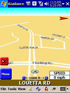
Unlike most other programs iGuidance does not outline streets (they don't have black borders). This could be seen as a design element, but in daily use it is rather making it more difficult to tell streets apart from other map elements.
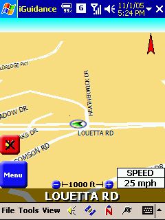 
Street names are rendered in an ever increasing font the closer you get to them, but it is rather difficult to read them due to the low contrast.
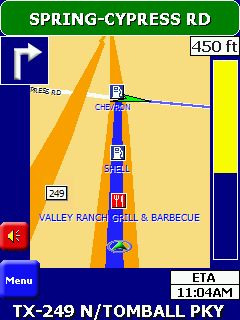
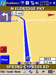
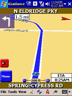
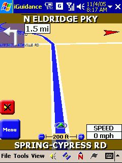
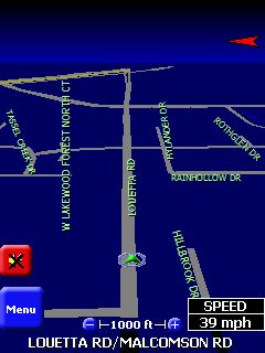
The status window in the bottom right can be tapped, and the information in it rotates between speed, remaining distance , ETA, and remaining time.
iNav comes with some interesting display options. Auto Day/Night mode switches to night colors shortly after sunset, and back to day colors shortly before sunrise. It does that based on your location. Pretty cool, eh?
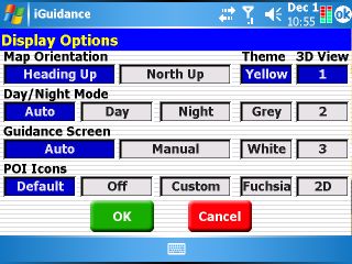
The guidance screen can be set to auto which will both influence the zoom in relation to your speed, and it will also reclaim screen real estate, removing the top title bar and bottom menu bar if you are driving at a certain speed. You can get both bars back by tapping the screen or by stopping.
The 3D views offer a good selection of viewing angles. However there seems to be a bug in the rendering that sometimes leaves most of the upper screen empty, cutting the map off long before the "horizon" and making the road you travel on look like a dead end.
Like every navigation program iNav has its share of oddities and missing functions. Here's a short list of those.
Me First!
When you switch to another program while iNav is running on a WM2003SE device the navigation screen will sometimes force itself back into the foreground, and you actually have to close iNav to - for example - make a phone call on your Pocket PC Phone Edition.
This takes us straight to the next "feature".
No Route persistence
iNav does not remember the route through program restarts, and it also doesn't remember your previous selections. This is a pity, and it is also one of the reasons why I consider iNav an entry level program. Too many things can happen to your Pocket PC that result in the application being closed, and having to recreate your route every time is painful, and may even be dangerous when you are driving.
At least iNav keeps a history of your most recent destinations, so you can recreate the route from that.
No Wakeup Calls please
If you leave iNav running and switch "off" your PocketPC, don't expect it to work again when you switch it "on" the next time (in reality you're putting the PDA to sleep and wake it up again).
For some reason iNav is extremely slow after wakeup, and you may not even be able to terminate it. Well, there's always the reset hole...
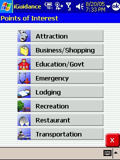
No custom POIs
Custom Points of Interest (POI) are very hip right now in Europe, with Speed, uhm, Safety camera locations clearly leading the pack. Custom POIs are also the answer of frustrated users to the sometimes atrocious quality of the built-in POIs offered by the big map providers. You take the task into your own hands and collect reliable sets of POIs that can be used as navigation targets or for POI warnings.
Unfortunately, iNav takes a triple hit here - the built in POIs are pretty limited in number of categories, the quality is not very good, and the program does offer neither a POI alerting feature nor an option to add custom POIs.
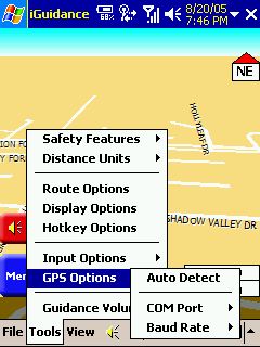
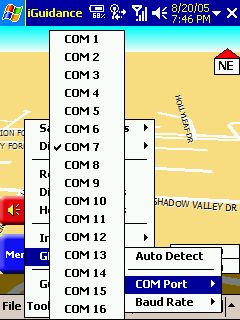
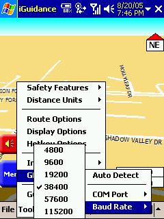
No COM0:
yes, for whatever reason COM0: is missing from the list of available ports. It is also not found by the automatic search ("Auto Detect"), and I was forced to reconfigure my WM5 device to use a different COM port. iNav should enumerate existing serial ports, rather than presenting a list from 1 to 16.
On the flipside, iNav offers some special features:
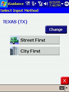
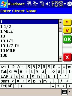
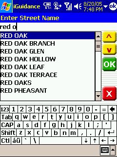
- Address entry: iNav gives you the option to enter the street name first and then select the city. This is a vital feature for navigation in the North American suburbia which is sadly missing from the majority of the more advanced programs. Search results are shown as you type the street name.
 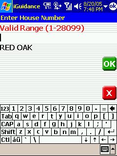
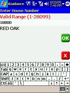 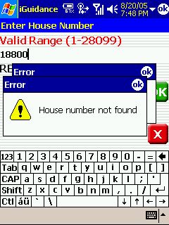
House number search is strict, only house numbers that are known to the iNav maps can be selected. You will see a lot of real life cases where this is not sufficient because the map is out of date and the newer house numbers are not listed. In that case you need to select the closest known house number and then at the destination sort out where your real target is.
- indication of side-of-road for the destination: iNav will announce that your destination is - for example - "200 yards ahead to the right" - a very nice feature, no matter if the destination is on a small subdivision street (where house numbers are clearly visible) or on a busy six lane main street where you have a hard time finding the few house number signs that may be hidden in clear sight amongst all the advertising.
- Navigation to Coordinates: Fortunately iNav has not followed the TomTom path of reducing functionality, and specifying Latitude/Longitude as a destination is still possible.
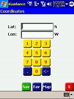
The program actually takes the concept one step further and performs a real time reverse geocoding - while you key in the latitude and longitude it shows you the corresponding street address (or at least the area name).
-Speed limit warning: iNav is the only program currently on the market that can warn you if you exceed the speed that the current road is designated for. This includes not only signposted speed limits but also general speed limits on motorways etc.
You get a little bleep and your current speed is displayed on red background if you drive faster than you should.
This feature certainly helps you to revisit you driving style... Not all roads have a recorded speed limit, and it may also not always be the correct one, but in my area (Greater Houston) it was pretty close to reality
- Almanach - all kinds of useful information about sunrise, sunset and moon phases - this helps you to plan for your next sleepless night...
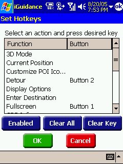
- Hotkeys - You can assign hardware keys to certain actions within iNav.
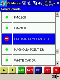
- Avoids - you can display the route list for a calculated route and then select to avoid parts of that list. iNav will then recalculate and find a route that does not include that part. Don't try this while driving though - it involves too many steps and you need to hit the small buttons pretty exact.
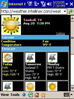
- weather service for your location: If your PocketPC has some kind of Internet connectivity then iNav will "call home" with your current location and your default web browser will open and show the weather for that location for today and the next five days. This service is free, and you only have to pay your telco for the data traffic.
- Route demo: You can tap-and-hold points on the map (while in 2D mode) and define them as start and destination points. Then you can run a route demo, complete with voice instructions. There's just a little caveat - the demo stops when you reached the destination, and the route gets cleared... I am sure iNav will fix that oversight quickly.
|


