Home PageFacebookRSS News Feed
PocketGPS
Web
SatNav,GPS,Navigation
Garmin GPSmap 60Cx handheld GPS review Date 06 March 2006

Review by Mike Barrett


Sometime ago Garmin was synonymous with GPS. Over the last few years this has changed somewhat, with GPS becoming a Mass-Market Consumer product. Where a few years ago handheld GPS receivers were the main sellers these have been far outstripped by Street Routing GPS (certainly in Europe anyway).


As the technologies have moved on so have the GPS receivers. Garmin have recently announced a major upgrade to their range of Handheld GPS receivers. Here we review the Garmin GPSmap 60Cx an all singing all dancing handheld GPS receiver.

Quick Navigation

Overview

Manufacturers Specs

Hardware Review

Software Review

Conclusion

Resources

Overview

A little over a year ago Garmin introduced the 60C and the 60CS. A few weeks ago they announced the latest upgrades to the range.


The main new features are the introduction of the super sensitive SiRFStarIII chipset. This is widely acknowledged as being the most sensitive and accurate chipset available at the time of writing. The other main addition to the receiver is the introduction of external storage in the form of MicroSD flash memory. Yep, these storage cards have just got smaller again.


The Garmin GPSmap 60Cx is a Mapsource compatible handheld. This means that just about all maps and applications available in the Mapsource range will work: Basemaps, Street Routing, Topographical, and Marine charts. The receiver is of course compatible with the newly announced Topo GB Mapsource product. (We will review the Topo GB map software in a separate review).


How does this all come together and work out in practice? Read on and find out. First we will describe the GPS receiver hardware, then the GPS software, and finally end up with a description of my experiences using the GPSmap 60Cx in the field.


The Garmin GPSMAP 60Cx GPS receiver

Whats in the box

The Garmin GPSMAP 60Cx comes with the following in the packaging:

  • GPSMAP® 60Cx unit
  • 64 MB microSD
  • Belt clip
  • USB interface cable
  • MapSource Trip & Waypoint Manager CD
  • Lanyard
  • Owner's Manual
  • Quick-Start Guide

Manufacturers Specifications

The official Garmin specifications for the GPSMAP 60Cx are:


From the Garmin site:
Navigation features

Waypoint/icons: 1000 with name and graphic symbol, 10 nearest (automatic), 10 proximity

Routes: 50 reversible routes with up to 250 points each, plus MOB and TracBack modes®

Tracks: 10K point automatic track log; 20 saved tracks 500 points each let you retrace your path in both directions

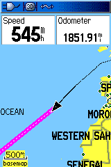
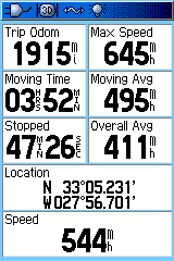
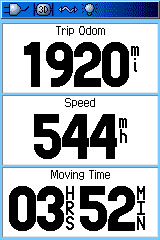
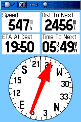
Trip computer: Current speeed, average speed, resettable max. speed, trip timer and trip distance

Alarms: Anchor drag, approach and arrival, off-course, proximity waypoint, shallow water and deep water

Tables: Built-in celestial tables for best times to fish and hunt, sun and moon rise, set and location

Map datums: More than 100 plus user datum

Position format: Lat/Lon, UTM/UPS, Maidenhead, MGRS, Loran TDs and other grids, including user UTM grid only

GPS Performance

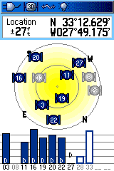
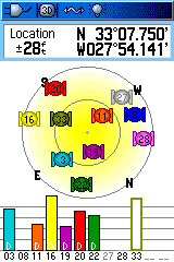
Receiver: 12 channel SiRFstar III™ high-sensitivity GPS receiver (WAAS-enabled) continously tracks and uses up to 12 satellites to compute and update your position

Acquisition times:

  • Warm: < 1 sec
  • Cold: <38 sec
  • AutoLocate™: <45

Update rate: 1/second, continuous

GPS accuracy:

  • Position: <10 meters, typical
  • Velocity: .05 meter/sec steady state

DGPS (WAAS) accuracy:

  • Position: <5 meters, typical
  • Velocity: .05 meter/sec steady state

Protocol messages: NMEA 0183 output protocol

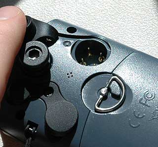
Antenna: Built-in quad helix receiving antenna, with external antenna connection (MCX)

Moving map features

Basemap: Detailed routable basemap with cities, highways, interstates, exit info, rivers lakes; preloaded with worldwide cities

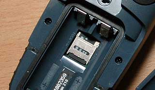
Uploadable maps: Accepts downloaded or plug-in microSD map detail from a variety of optional MapSource media (64 MB microSD card included)

Electronic Compass feature: (GPSMAP 60CSx only)

Accuracy: +/- 2 degrees with proper calibration (typical); +/-5 degrees extreme northern and southern latitudes

Altimeter feature: (GPSMAP 60CSx only)

Resolution: 1 foot

Range: -2,000 to 30,000 feet

Elevation computer: Current elevation, resettable minimum and maximum elevation, ascent/descent rate, total ascent/descent, average and maximum ascent/descent rate

Pressure: Local pressure (mbar/inches HG)

Power

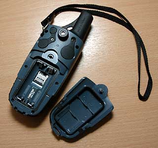
Source: Two "AA" batteries (not included)

Battery Life: 18 hours, typical; up to 30 with battery saving

Physical

Size: 2.4W x 6.1H x 1.3D inches

Weight: 7.5 oz. (213 g) est.

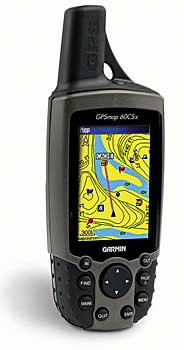
Display: 1.5 x 2.2 inches (38.1mm x 56mm) 256-color transflective TFT (160 x 240 pixels) (160 x 240 pixels)

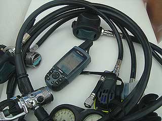
Case: Waterproof to IPX-7 standards

Temp. range: 5ºF to 158ºF (-15ºC to 70ºC)


The Garmin GPSmap 60Cx Hardware

On first impression the 60Cx looks a little strange. A little like an old mobile phone. This is mainly due to the antenna protruding from the top of the GPS receiver.


Just below the antenna in the main body of the GPS is the screen. This is a bright transreflective TFT screen measuring 1.5" wide by 2.2" high and having a resolution of 160 by 240 pixels.


Under the screen are a whole host of buttons and a multi way joypad. Starting at the top left and following the buttons anti-clockwise the buttons and their functions are:


Zoom in: change the display scale for more detail.
Find: display the find menu, allows selection of Waypoints, Cities, Geocache, Marine, Freeway Exits etc.

Mark: create a waypoint at the current position.

Quit: generally exits the currently selected function.

Enter: Selects the currently highlighted option/function.

Menu: displays a context sensitive menu for the page you are currently viewing.

Page: cycles through the main displays (see below).

Out: change the display scale for less detail.

The Garmin GPSMAP 60Cx GPS receiver

The Garmin GPSmap 60Cx


The image to the right shows the detail of some of the features of the rear of the GPSmap 60Cx. On the left side of the rear there is the lanyard attachment, plus two connectors:


USB: this is the connection to transfer data to and from a computer. Note that this connection cannot be used to relay live position data to an attached PC.


External Antenna: despite the GPS receiver having a SiRFStarIII chipset there are occasions when even the sensitivity of this hardware is stretched. This is where you might need an external antenna to increase the signal receiver by the 60Cx. You would typically consider using this in a car with a coated windscreen which blocks the GPS signal.

The Garmin GPSMAP 60Cx GPS receiver

The Garmin 60Cx external antenna and USB sockets


Both of these sockets are protected by rubber bungs. These help protect the GPS from some of the more harmful elements that might try to get inside the unit. Like water, or sand.


The image to the right shows a number of features:


Serial Connector: This allows the transmission of data between the GPS and older PCs using serial data protocols.


Belt Clip Button: The belt clip button sticks out about 1/4 inch from the back of the GPS and snaps into the clip.


Speaker: The four small holes provide output for the sound tones from the GPSmap 60Cx.


Battery Latch: The metal 'D' latch secures the batteries in the sealed battery compartment.

The Garmin GPSMAP 60Cx GPS receiver

The GPSmap 60Cx serial socket


The battery compartment is sealed with a rubber gasket making the whole unit waterproof to the IPX7 standard. The IPX7 standard means the GPS case can withstand accidental immersion in one meter of water for up to 30 minutes. This is something that must be evaluated... See the in use section below.


The power source for the 60Cx is a pair of AA sized batteries. It is claimed that you can get up to 18 hours usage from a set of batteries. You can use both normal alkaline batteries or rechargeable ones.


The most interesting thing in the battery compartment is actually under the batteries. This is the microSD card. This extends the storage capacity of the GPS and can be used to have different mapping sets on different cards.


The Garmin 60Cx is supplied with a 64Mb microSD card as standard, but you can buy cards with capacities up to 512Mb (I have seen them for £23 on the internet). So far the 64Mb card has been sufficient for my needs. The size of these cards is amazing. They are about half the size of a mobile phone SIM card.


Garmin provide an application called Mapsource to allow the management of maps, waypoints, routes and tracks between the GPS and the PC. This transparently transfers data to the GPS microSD as required. You can buy a number of different Mapsource products providing different mapping for the GPS from navigable street mapping to Topographical data and Marine Charts.

The Garmin GPSMAP 60Cx GPS receiver


The Garmin GPSMAP 60Cx battery compartment


The Garmin GPSMAP 60Cx GPS receiver


Close up of the GPSMAP 60Cx microSD card.


The final external feature is the antenna. Normally GPS units "fall to pieces in my hands" I didn't risk it with the 60Cx, but just looking at it it is obvious that the internal antenna is one of the Quad Helix type.


The Quad Helix is not quite as sensitive as a ceramic patch antenna, but does have the advantage that it is omnidirectional enabling the the GPS to work effectively at any angle.


Coupling the Quad Helix antenna with the SiRFStarIII chipset provides you with a super sensitive and accurate GPS receiver that will work just about anywhere (within reason), with good strong signals.


That just about covers the external features of the 60Cx. Lets take a look at the software onboard now...


The Garmin GPSMAP 60Cx GPS receiver

The Garmin GPSmap 60Cx built-in antenna

The Garmin GPSmap 60Cx Software

The first thing you see when you switch the Garmin 60Cx on is a welcome screen. You can place some custom text on here. Once the unit has started you will see the Satellite Display. This can be configured either as a single colour or multicolour display. The multicolour satellite display helps you identify which satellite is where in the sky by matching colours on the bars to those on the main display.


The bars indicate the signal strength. A blue/coloured bar shows that the satellite is being tracked and used to calculate your position. The white bar shows that the information for that satellite is still being downloaded.

The Garmin GPSMAP 60Cx GPS receiverThe Garmin GPSMAP 60Cx GPS receiver

If the GPS is receiving a WAAS correctional signal then there will be a 'D' at the bottom of the bar.


There is a night mode which has a subdued colour scheme so you don't burn your eyes out in the dark. Or in my case disturb other passengers on the plane.


If you press the menu key then a context sensitive menu will be displayed allowing you to set the options for the satellite display. Options are are to set up the orientation and colours, switch off the GPS reception, or specify a new location if you have moved a significant distance since last usin the GPS.

The Garmin GPSMAP 60Cx GPS receiverThe Garmin GPSMAP 60Cx GPS receiver

Pressing the "Page" button moves you between the the information screens. The next screen I see is the map display. The order and number of the screens can be configured in the setup options.


The screen shot to the immediate right shows the normal map screen. As you may have guessed I am not traveling down the road at 544MPH I am on my way to Barbados. Virgin Atlantic kindly let me use my GPS on the way. The black arrow is your current position. The cerise line shows a course line to my destination. The black line is the track of my journey.


At the top of the display are some data readouts. You can configure these to be either 0,2,3, or 4 items and you can configure each of these items.


The Garmin GPSMAP 60Cx GPS receiverThe Garmin GPSMAP 60Cx GPS receiver

If you use the rocker button an arrow cursor appears and you can scroll around the map. As you move over map features these are identified. The far upper right image shows a waypoint, the map to the immediate right shows Barbados. You will notice that the night view colours are selected for this map.


Hitting the quit button takes you back to the standard map view. Hitting the menu button displays the contact sensitive options for the map screen. These include options to recalculate your route (if you have street mapping installed) and to remove some items for the display to make it more readable. You can configure the displayed data fields from this menu as well.


There is a lot more features available on this screen when used with street maps. I will cover those in a separate article focusing on the Garmin Mapsource products.


The Garmin GPSMAP 60Cx GPS receiverThe Garmin GPSMAP 60Cx GPS receiver

The next screen is the Trip Computer. This is a highly configurable screen with 8 different items that can be displayed.


Each of the data fields can be configured to display any of the datum available in the GPS. The lower 2 fields are double width which makes it ideal for displaying longer items such as the GPS position.


An option of the Trip Computer is to display "Big Figures". This reduces the number of displayed items to 3 but with much larger characters. This is useful for oldies like me who have difficulty reading small figures (only joking). It is actually really useful when you have the GPS mounted on a bike enabling you to read the important figures easily.


The Garmin GPSMAP 60Cx GPS receiverThe Garmin GPSMAP 60Cx GPS receiver

The next screen is the compass display. This shows you the direction to the next waypoint on your route with the big red arrow. It also shows your bearing on a compass rose.


This is a GPS compass not an electronic one so you need to be moving for it to show an accurate direction.


Again there are a number of configurable data fields. You can select either 3 or 4 to be displayed. The most obvious ones are those that relate to your current route.


The Garmin GPSMAP 60Cx GPS receiver

The final screens I have shown here are to the right. These are the main setup screens. The one to the immediate right is the main setup screen. The other is the system setup.


As you can see there is a whole wealth of things that can be configured to allow you to customise the GPSMAP 60Cx to your precise requirements. I wont go through all the options here, but you can get the gist of what is available from the icons.


I have only really just scratched the surface of the functionality of the Garmin GPAMAP 60Cx here. There are so many features such as routes and waypoints that are all built in, some of these I will cover in the in use section below.


The Garmin GPSMAP 60Cx GPS receiverThe Garmin GPSMAP 60Cx GPS receiver

The Garmin GPSmap 60Cx in use.

In true 'Mike' style I cannot just go on vacation without working... To the right is my version of the essential travel kit, forget your toothbrush, it has to be iPod, Bose noise canceling headphones, a copy of T3 and of course a GPS.


Well actually I always carry rather more than one GPS, but normally only have a single handheld GPS receiver in the flight cabin. This time it was of course the Garmin GPSmap 60Cx.


If you are taking a GPS onboard a plane please check with the cabin crew to ensure that you can use it. Different airlines have different rules so you do need to ask a member of the cabin crew. I flew Virgin and they permitted GPS tracking once up in the air.

The Garmin GPSMAP 60Cx GPS receiver


I was taking a well earned (so I reckon) break to Barbados to get away from the snow, ice and rain of the UK winter. Now there is very limited mapping in Barbados, infact Barbados isn't even on the basemap supplied with the Garmin GPSMAP 60Cx. However, the Garmin MapSource BlueChart does have the nautical charts of the area, and as I intended to take a diving course the BlueChart data would be useful. I will be doing a full review of the BlueChart data in another article.


The basemap was ideal for tracking my progress during the flight. I had set a waypoint in the centre of the runway at Grantley Adams airport. This allowed me to check up on the pilot, making sure he was going the right way.


The Garmin GPSMAP 60Cx GPS receiver

Of course we were and as we approached Barbados the captain very kindly over flew the airport and gave us an aerial view of the Barbados Hilton where we were staying along with Carlisle bay and the Caribbean Sea (pictured on the right) where I went diving.


The sensitivity of the GPSMAP 60Cx was stunning, surprising even me! I had the GPS receiver in the centre of the cabin and was still getting a 5 satellite differential fix. Normally even with SiRFStar III receivers you need to have them near the window.


The Garmin GPSMAP 60Cx GPS receiver

As I mentioned above you can organise your GPSMAP 60Cx using the Garmin MapSource application. This transfers maps, routes, waypoints and tracks between your PC and the GPS receiver. I had preloaded the BlueChart marine charts of the Barbados region prior to leaving home, and found the Airport and created a waypoint at the airport. This allowed me to track my progress during the flight. I had also marked Gatwick so I was able to track our return as well.


Now the Marine charts don't contain too much information on the road network, and in Barbados road signs seem to be nonexistent. But this was not too much of an issue once our destination had been pinpointed. I set a Waypoint at our hotel, and was able to navigate with (almost) as much confidence as with normal street mapping systems.


When I was out driving it was a simple matter of selecting a road that was heading roughly in the direction shown on the GPS. We had a bit of fun in the capital Bridgetown, but we never got lost.


As mentioned above the GPSMAP 60Cx is certified to the international IPX7 standard. This is a requirement if you are going to use it for navigating on the water. In particular salt water and electronics don't mix very well. I can put my hand on my heart and say that this GPS receiver is certainly waterproof.


The Garmin GPSMAP 60Cx GPS receiver

Not only did I take it out every day on an open dive boat, but getting in and out of the boat the GPS (and the rest of me) got completely submerged in the waves. I also had to ensure that all the salt water and residue were washed off. This entailed dunking the GPS in a barrel of fresh water. Not a single drop of water entered the GPS.


I used the GPS as a recording tool for the dive trips. we made a number of dives in Carlisle Bay and also out in the Caribbean Sea. At each location I created a mark or waypoint so that I could return to that spot again if I ever go back there (tickets booked for next year). In the screen dump from the MapSource application you can see the dive trip from the 30th Jan highlighted in yellow. There are many other tracks shown in white there as well.


On one of the tracks the one exiting to the left of the image we did a dive in the open sea. I made a mark where we entered the water, and a second one where we were picked up. We had moved nearly 3/4 of a mile in the dive from our entry position.


Apart from my fun in Barbados I have also used the GPSMAP 60Cx as a street navigation system. The Topo Great Britain mapping software is a combination of NavTeq street routable maps and Ordnance Survey topographical data (things like contours, paths, rivers and streams). The street mapping side of the software can create turn by turn instructions, including recalculation if you go off route, to your destination. It is not the same quality as the dedicated personal navigation devices, as it doesn't issue voice commands. However it does beep to indicate a turn and the turn instructions are clearly displayed on the screen.


If you do want to use the Topo Great Britain you will need to get a larger microSD card as the 64MB one supplied with the GPS receiver only allows a small number of tiles to be downloaded. This is not as big an issue as it might seem. I can get most of the south east of England on the 64Mb card. I don't really need all of that in such great detail. What I can do is load the detail for the areas that I need it and then leave the rest as the Base Map. The Basemap contains routeable information of major roads so you get the best of both worlds. Detail at your start and destination, with major roads in between.


Further reviews are being prepared for the MapSource Topo Great Britain and BlueChart products.


Conclusions

The Garmin GPSMAP 60Cx is the best handheld GPS receiver I have seen to date. It is multifunctional and can be used for driving and routing on the road, on bike. foot or in any other off road scenario, and also for marine use.


It is a very rugged device, it took a fair amount of abuse while I was in Barbados, it is weather and waterproof. I took it in some places where I would normally not dream of taking my PDA or any other GPS receiver.


It is amazingly sensitive. The wizards at Garmin have sprinkled their magic dust on the design and production of the 60Cx squeezing the last bit of sensitivity from the antenna and SiRFStar III chipset.


If you are looking for a good all round GPS then this is hard to beat. This is definitely one GPS that will accompany me on my travels.

Pros

  • Great Multifunction GPS
  • Typical Garmin high quality build
  • Amazing sensitivity
  • Rugged and endurable. You can throw anything at this GPS
  • Excellent range of international mapping products available
  • Abundance of customisation options.

Cons

  • A tad expensive at £360 street price
  • Additional mapping required
  • Supplied microSD card a little too small


References

Suppliers Website www.garmin.com
Pocket GPS Contributor

Mike Barrett

Pocket GPS Contributor Website

www.pocketgpsworld.com


Comments ?

Have any comments about this review ? Post them here.

CamerAlert Apps


iOS QR Code


Android QR Code


© Terms & Privacy

GPS Shopping