| OpenStreetMap - Now YOU can take control of the maps
 We've posted about OpenStreetMap (OSM) a number of times over the years but it wasn't until recently that I realised just how much the map data had improved. We've posted about OpenStreetMap (OSM) a number of times over the years but it wasn't until recently that I realised just how much the map data had improved.
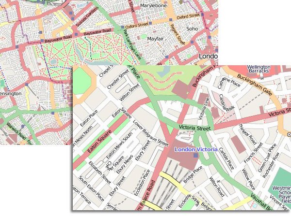
Browsing the OSM map via a GPS app on my iPhone I was amazed at how good it is with many large urban areas comprehensively covered. Take a look for yourself at OpenStreetMap.
Of course the first thing we all do is check our local area. Browsing my local streets I noticed many of the side roads were missing or lacking road-names and so I thought I'd add them.
OSM is an open source GPS map created by users from GPS tracks and traces. YOU can edit the map, correct errors, add new roads etc and its surprisingly easy once you have had a practice.
With my data-logger charged I set off to drive all the local side streets to capture their GPS tracks. Then all that needs to be done is for the tracks to be uploaded to OSM in .gpx format. Using one of the editor applications (there are many available, I used the web based Potlatch) you can view your uploaded 'traces' on the master map which allows you to add and precisely position your missing streets. Once done you can easily categorise the road and add its name.
I added seven new streets last night and they are now available on the master map. It gives you an enormous sense of pleasure to see your edits appear, no more waiting for TeleAtlas or Navteq to correct a map or add a new road.
Of course, at the moment the OSm map is not navigable or usable in turn by turn applications but it won't be long before it could be. if we all added a road or two we could get the UK comprehensively mapped very quickly.
So come on, what are you waiting for! http://www.openstreetmap.org/.

Images courtesy of OpenStreetMap
| Comments
|
 Posted by Eddiejen on Wed Mar 11, 2009 12:41 pm Posted by Eddiejen on Wed Mar 11, 2009 12:41 pm |
 |
I think this project is underestimated. I agree,
if everybody who accesses pocketworld did a bit of logging and filled in the gaps it would rival the main map providers.
Once routable applications arrive the map data could be freely used.
Should pocketgpsworld have a dedicated forum and promote openstreetmap land organise logging get togethers or partys ?
|
|
 Posted by Eddiejen on Wed Mar 11, 2009 12:44 pm Posted by Eddiejen on Wed Mar 11, 2009 12:44 pm |
 |
Sorry! I didn't see the other posts !!!
|
|
 Posted by scarymonkey on Wed Mar 11, 2009 12:48 pm Posted by scarymonkey on Wed Mar 11, 2009 12:48 pm |
 |
I had planned to map most of my town a month or so back, until I realised that it had been done not long before in an organised mapping event.
I have removed a couple of now incorrect point of interest tags though since things have changed with that since the mapping was done - just to rpove mapping is a continual cycle.
Vince Marsters |
|
 Posted by carl_w on Wed Mar 11, 2009 2:21 pm Posted by carl_w on Wed Mar 11, 2009 2:21 pm |
 |
As long as this doesn't go the same way as Gracenote (and some would say PGPSW SCDB  ) by getting the poor mugs of the public to do the leg work, then later packaging the whole thing up as a commercial offering. ) by getting the poor mugs of the public to do the leg work, then later packaging the whole thing up as a commercial offering.
|
|
 Posted by Darren on Wed Mar 11, 2009 2:41 pm Posted by Darren on Wed Mar 11, 2009 2:41 pm |
 |
| carl_w Wrote: | As long as this doesn't go the same way as Gracenote (and some would say PGPSW SCDB  ) by getting the poor mugs of the public to do the leg work, then later packaging the whole thing up as a commercial offering. ) by getting the poor mugs of the public to do the leg work, then later packaging the whole thing up as a commercial offering. |
Uh as someone who benefited from a lifetime subscription as did many others that wasn't a bad deal for a poor mug! So let's not dig up that again please.
Darren Griffin |
|
 Posted by GerryC on Wed Mar 11, 2009 3:57 pm Posted by GerryC on Wed Mar 11, 2009 3:57 pm |
 |
WHAT? My local isn't shown - better fix that!
Also, I'm going to get weird looks walking around near my parents as none of the small roads are shown. I'll be good and label the roads correctly as well - something TeleAtlas haven't managed to do. 
Gerry
TomTom730T
Cameralert for Android
Brodit ProClip mount |
|
 Posted by carl_w on Wed Mar 11, 2009 5:08 pm Posted by carl_w on Wed Mar 11, 2009 5:08 pm |
 |
| Darren Wrote: |
Uh as someone who benefited from a lifetime subscription as did many others that wasn't a bad deal for a poor mug! So let's not dig up that again please. |
Hence the smiley ;)
But the point is still valid. What's to prevent the OpenStreetMap people collecting all the data and then going commercial? Are there any guarantees in place, or availability of the DB under GPL?
|
|
 Posted by Darren on Wed Mar 11, 2009 5:24 pm Posted by Darren on Wed Mar 11, 2009 5:24 pm |
 |
| carl_w Wrote: | | But the point is still valid. What's to prevent the OpenStreetMap people collecting all the data and then going commercial? Are there any guarantees in place, or availability of the DB under GPL? |
There is some discussion on this issue here.
Darren Griffin |
|
 Posted by Eddiejen on Wed Mar 11, 2009 5:44 pm Posted by Eddiejen on Wed Mar 11, 2009 5:44 pm |
 |
having read the link I see they are trying to protect contributors to the project and prevent abuse by others using the information. It was well worth reading!
One other project to support is the free the postcode at http://www.freethepostcode.org/
The projects seem to be closely related in helping to free up geographical data and in my opinion will only help to allow the development of postcode lookup navigation for openstreetmap maps.
|
|
 Posted by MaFt on Thu Mar 12, 2009 4:54 pm Posted by MaFt on Thu Mar 12, 2009 4:54 pm |
 |
i got a call from a friend the other day who lives on a cul-de-sac... asking me why i drove up his road then reversed back out again!!
thankfully he's heard of open street map!! i've got a lot of work to do for my area... still, i'll get there!
had some on the master map already and yes, it's rather satisfying!
MaFt
|
|
|
| Click here to view more comments... |
|
 |
|