Navitel Brings More Eastern Promise
Article by: Darren Griffin
Date: 1 Dec 2011
Navitel, purveyor of mapping solutions for a number of Eastern European countries, has updated its iOS SatNav app.
The latest update to v5.0.3.222 introduces a number of new features including the option to purchase maps for other countries in-app, updates to dynamic POIs and a new night colour scheme.
A new addition is a free, interactive, service that allows you to data on traffic accidents, road works and other incidents as reported by other Navitel users.
Navitel have map coverage of Estonia, Latvia, Lithuania, Belarus, Poland, Czech Republic, Slovakia, Ukraine, Hungary, Romania, Moldova, Bulgaria, Slovenia, Hungary, Bosnia and Herzegovina, Serbia, Montenegro, Makedonia, Albania and Greece.
Navitel is available in the AppStore here. The full press release follows:
30 of November 2011: Navitel Navigator update for iOS:
Additional maps are available for purchase, new online services and map updates of all countries release Q3-2011!
Navitel Navigator update 5.0.3.222 for iPhone, iPad, iPod users includes new online services and map updates of all countries release Q3-2011 with an option of additional map packages purchase.
For iPhone, iPad and iPod users Navitel 5.0.3.222 versions are available, including updated maps release Q3-2011 and many more new functions and new online-services.
List of changes for Navitel Navigator 5.0.3.222 on iOS:
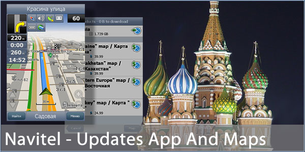
• Option of additional Navitel maps purchase is available now
High-demanded by our users option of license additional official map packages purchase right from the program. To buy license for additional maps, go to Navitel Navigator menu: Menu-Settings-Map-Map, then choose option “Additional” (button in the middle below)-Download new maps.
• New free interactive service NAVITEL.EVENTS!
This service allows users to mark and see on the navigation device map other users’ marks of the following types of road events: road accidents (with lanes segmentation), car crashes, road works (with lanes segmentation), other warnings, and also to mark at the map detected speed cameras.
All marks, published by user, can be commented with text messages. Users can confirm or decline events, published earlier by others.
Navitel.Events information is updated along with traffic jams data.
Marks will automatically disappear three hours later after last event confirmation.
You can learn more about Navitel.Events service at web-site section “Online Services”.
• Intersections search. New function, available at address search, was added upon requests of Navitel Navigator users. With intersections search you can easily find on the map point of two different streets or roads crossing and make a route to it or see it at the navigation device display.
• Night skin is updated. Now at night time information from navigator display can be read easier.
• City districts display in address search. During street search under street name now you can also see district, where it is located.
• More information in Navitel Dynamic POI.
For example, while downloading additional information about gas prices at the gas stations, you can see the date of last prices update.
• Pedestrian crossings in SPEEDCAM. Now pedestrian crossings are also included in dangerous road sections package. Driver needs to lower the speed and increase attention. At the moment new SPEEDCAM information with pedestrian crossings is available only for Kazakhstan citizens. Soon SPEEDCAM with pedestrian crossings will be also available for other countries citizens. As previously Navitel users can create their own SPEEDCAM storage, now also with pedestrian crossings.
• Total work stability and navigation program speed are also increased.
• Navitel navigation maps release Q3-2011 update.
Along with program update, Navitel Navigator navigation maps release Q3-2011 update is also available for users.
Road network and address base data in cities and municipalities are updated in maps of all countries, taking into account messages of Navitel users at the official forum and through bug-tracker of the official web-site.
You can download Navitel 5.0.3.222 update with maps release Q3-2011 in iTunes.
Don’t forget that free Navitel Navigator full trial version is available for new users during 30 days.
Good news for iPhone and iPad users, planning Eurotour in Eastern Europe! Navitel is reducing the price for popular maps package Navitel Navigator Eastern Europe: from 30th of November 2011 it costs just 65$!
In Navitel Eastern Europe package licenses for 20 European maps are included: Estonia, Latvia, Lithuania, Belarus, Poland, Czech Republic, Slovakia, Ukraine, Hungary, Romania, Moldova, Bulgaria, Slovenia, Hungary, Bosnia and Herzegovina, Serbia, Montenegro, Makedonia, Albania and Greece.
| | |  |
| Comments
|
| Be the first to comment. Click on Post Reply below. |
|
|
 |
|


