|
|
 |
 |
 |
 |
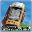
Cartogoo - GPS Surveying and map making software
Article by: Darren Griffin
Date: 12 Feb 2010
 Cartogoo have announced a new GIS and survey data solution that makes data collection as simple as possible. Cartogoo have announced a new GIS and survey data solution that makes data collection as simple as possible.
The software, compatible with Windows Mobile/CE and Windows XP, Vista and 7 is a software tool that makes it supremely easy for non-surveying professionals to gather data using a GNSS receiver.
The software allows you to view all the graphics and survey tools on the handheld device and is designed for use in a range of industries including architectural, utilities, land registry and forestry.
All survey data can be output in standard formats including .kml, DXF, DWG etc and the desktop software uses a Google Earth interface.
For more information see Cartogoo's web site here.
| Comments
|
| Be the first to comment. Click on Post Reply below. |
|
|
 |
|
|
 |
 |
 |
 |
|
|


