| CES 2010: NDrive Vegas - iPhone App with aerial imagery
Article by: Darren Griffin
Date: 6 Jan 2010
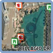 To mark CES 2010, NDrive have released a Las Vegas version of their NDrive iPhone Navigation application. To mark CES 2010, NDrive have released a Las Vegas version of their NDrive iPhone Navigation application.
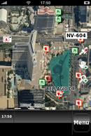
Complete with aerial photography, NDrive Las Vegas offers a detailed map of the city with full navigation, voice guidance and an extensive POI database.
NDrive's navigation solutions are unique in their use of oblique aerial photography provided by Blom Aerofilms. The aerial photography includes imagery taken from five different angles for the best user experience.
Ideal for Vegas residents, attendees at CES or anyone visiting or planning a visit to Sin City.
And better still, whilst CES is in session NDrive are offering the app for FREE. Download from iTunes below.
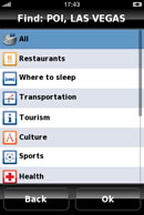 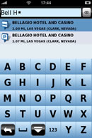 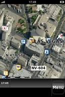 

www.NDrive.com
| Comments
|
| Be the first to comment. Click on Post Reply below. |
|
|
 |
|