 Review by Peter Bailey Review by Peter Bailey
Introduction
NavGPS is a well thought out and comprehensive aeronautical navigation system for Pocket PC's and works with most types of GPS Receivers. Versions are available for Windows (PC), ARM/ Xscale, MIPS and SH3.
 The system is available with vector based worldwide topographical maps and aeronautical data and can be downloaded from www.gonavgps.com.
The cost is $199 for a single licence, with aeronautical info updated on a 28 day basis at a cost of $80 p.a. The system is available with vector based worldwide topographical maps and aeronautical data and can be downloaded from www.gonavgps.com.
The cost is $199 for a single licence, with aeronautical info updated on a 28 day basis at a cost of $80 p.a.
A free 30 day trial is recommended but this comes with only 20 mins of active gps use.
On-line support is prompt and friendly.
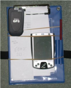
For evaluation purposes we were granted a single licence and proceeded to load the program and maps onto a CF card for use with an iPAQ 2210/Emtac CRUX combination.
This proved to be an effective and compact combination, fitting nicely onto a standard pilot's kneepad, and no wires.
For our test flight in a Robin DR400 aircraft the Emtac worked OK actually clipped on the kneepad but picked up more sats when placed by the windscreen.
With our intention to fly in S.E. England we had to load 2 topographical maps and an aerodata file plus an additional client produced database for smaller airfields, (available on the website), as the regional data only includes major airports. This data was simply copied from the PC to the CF card.
Installing
The program needs to be installed, run on the PDA and then a licence code obtained from GoNavGPS website to match the indicated PDA code.
The program started in my study, first time, with the gps autofind feature locating the BT signal on COM8 and showing the aircraft type cursor in position over my home.
Flicking through the screen options, by pressing the centre button, immediately showed the scope of the product. HPI, satellite status, position and journey data.
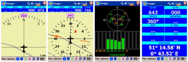
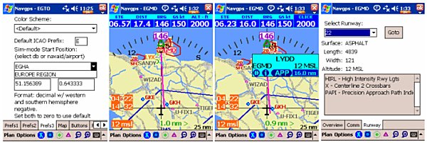
A good place to start exploring is the 'simulator mode'. This defaults to Germany on the topo. map but can be set to any centre required by simply entering the airfield code in 'Prefs3'., I chose EGKH, Headcorn in Kent and have a screen display of S.E. England.
Lydd, EGMD, was selected as a destination and runway 22 selected. A tap on the EGMD marker and local info was provided.
With a course set the sim plane follows it at 150 knots with the auto zoom facility always keeping the next waypoint in view, i.e. zooming in as the waypoint is approached.
Options and features
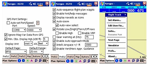
The operation of Navgps Pro is quite flexible with a good choice of alternatives. A comprehensive manual is available on the website for those who want to explore precise operating details, however the system becomes easy to understand after, say, 1 hour of practice with regularly used features quite instinctive.
The simplest operating mode is to press button 1, type in the next waypoint reference, and navigate.
Or tap on a VOR or airport, tap the blue indicator and get a vector with distance and direction.
For multi stage flight plans, tap plan, enter and simply insert your waypoint references, with a space between them and the plan is set. E.g. U-FIX2 EGKH sets a path via Beachy head to Headcorn, U-FIX being a user set waypoint, simply by tapping the screen.
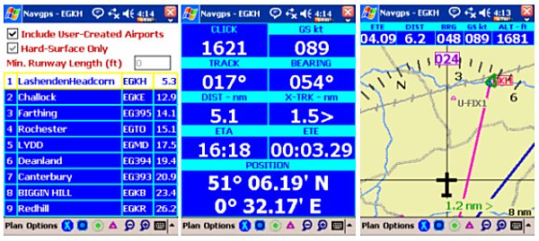
As the basic airport list is only for large, tarmac fields there is a facility for providing your own listing of minor establishments, i.e. as used by the client database when first loading the CF card.
With up to date aero information the approach mode is available and will indicate an extended runway dotted line to assist in your landing. Approach mode is disabled after 28 days unless an up to date version is obtained and fee paid.
Or, press button 4 and select an airport from the list, tap and go. On screen buttons control the zoom level and type of nav-aid displayed, together with the simple to understand plan and options menus. All hardware buttons can be custom set, allowing for features like pda screen on/off for battery economy. The auto sequencing feature enables the system to fly to the waypoint closest to the direction of flight, with manual sequencing the program will simply follow the waypoints as entered in the flight plan.
Test Flight
We opted to use Navgps Pro on the return leg of a flight to Headcorn from Bembridge, Isle of Wight.
As we had decided on a coastal route we inserted a waypoint (U-FIX2) near to Beachy head, simply by a couple of screen taps. This would be our first marker followed by a direct leg to Headcorn, EGHK. We initially followed the plan but decided to keep closer to the coast, this is clearly show by the black, actual track alongside the pink plan line.
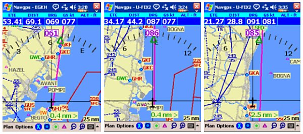
The planned track passed over the Seaford beacon, SFD to our point of turn and then on to Headcorn.
Once past U-FIX2 the system realigned to the new course, 038deg.
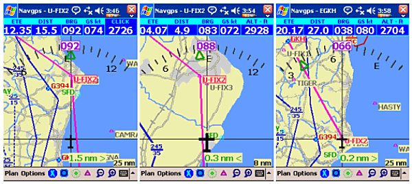
The summary screen clearly show height, speed, distance etc. with an ETA Headcorn of 4.17 pm
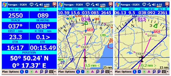
Nearer to Headcorn we keyed up the nearest airport screen and confirmed our position vs emergency options before changing course to approach Headorn airport from the west, prior to our final descent.
The system worked well with the only criticism relating to the rather sparse topographical detail and lack of place names, even at high zoom.
Thanks also to Pevelius, one of our Finnish flying contributors, for his in-flight experience and comments
Summary
Navgps Pro is a mature and effective navigation aid for pilots.
The Navgps customer agreement stresses that it should only be used as a back-up to other forms of navigation and that is the approach we always take when flying with portable gps systems. Our VFR plan includes VOR tracking and paper maps with navaid and airport frequencies on the kneepad.
In comparison to a CAA map the topographical data is quite limited and we did miss not having the names of towns available which meant double checking with a paper map when reporting position.
We found the system easy to install and operate with many useful features to re-enforce our navigation decisions and would recommend it for consideration by any serious amateur pilot.
|


