MikeB
Frequent Visitor

Joined: 20/08/2002 11:51:57
Posts: 3859
Location: Essex, UK
|
 Posted: Fri Feb 18, 2005 12:05 am Post subject: FUGAWI Release Marine ENC Version 4 Posted: Fri Feb 18, 2005 12:05 am Post subject: FUGAWI Release Marine ENC Version 4 |
 |
|
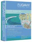
 Fugawi are currently exhibiting at the Miami International Boat Show. To co-incide with the show Fugawi have released the latest version of thier Marine mapping software which uses amongst other charts and map formats the NOAA ENC standard, hence the name. Fugawi are currently exhibiting at the Miami International Boat Show. To co-incide with the show Fugawi have released the latest version of thier Marine mapping software which uses amongst other charts and map formats the NOAA ENC standard, hence the name.
Amongst the new features in the software are 3D visualisation of charts and maps, the overlaying of Street data, and (if you have the appropriate receiver) it will display the position of commercial shipping or any other traffic with Automatic Identification System (AIS) data.
Fugawi are exhibiting at the Miami International Boat Show in booth 1653. If you are going there mention that you saw the press release on www.PocketGPSWorld.com. Check out www.fugawi.com for more details.
| FUGAWI Press Release wrote: | FUGAWI MARINE ENC™ VERSION 4 MAKES ITS DEBUT
Enhanced Navigation Software Makes Charting Easier Than Ever Before
Toronto, Canada – Northport Systems, Inc., a leader in GPS mapping software and innovative GPS applications, announced today the release of Fugawi Marine ENC Version 4, the latest version of its powerful and popular marine charting software. The new Fugawi Marine ENC software is the first product available on the market to not only allow boaters to take advantage of the over 450 up-to-date and free-of-charge NOAA ENC® coastal water and iENC inland waterway vector charts of U.S. waters, but to also add value to the ENC format with powerful features that aid in chart interpretation, such as 3D perspectives, marine services and superimposed streets and place name data. Whether used as a primary charting solution or as a secondary backup, Fugawi Marine ENC delivers the navigation features boaters need, at an unbeatable price.
Fugawi Marine ENC Version 4 now includes a number of unique and innovative features that make referencing a position easier than ever. New 3D Chart Visualization and Navigation capabilities allow boaters to view ENC, BSB, or SoftChart nautical charts in 3D. The 3D window aids chart interpretation when navigating in coastal waters, by providing a “ships eye” perspective on the “lay of the land.” The Fugawi Street Overlay™ feature provides a valuable enhancement to the already superb ENC nautical charts by overlaying U.S. street maps for added on-shore detail. The software also incorporates a comprehensive directory of useful information including 1.8 Million Place Names, as well as a built-in list of over 25,000 Marine Services from the MPC Boaters Directory, all of which are plotted on top of the charts in their precise location and easily toggled on or off.
Safety enhancements are also now a major component of the new Fugawi Marine ENC Version 4 with the addition of support for the Automatic Identification System (AIS). When combined with a third-party AIS radio
receiver, boaters can view commercial vessel traffic directly on top of ENC or other charts. Information transmitted may include vessel name, call sign, speed, heading and projected course. More information about AIS, and which vessels are required to broadcast this information, is available from the official US Coast Guard website: www.uscg.mil.
“With innovative ways to help boaters interpret chart data, an improved, easier to use interface and an exciting new AIS safety enhancement, Fugawi Marine ENC is perfect for anyone who spends time on the water,” said Sam Rea, president of Northport Systems. “It is also important to remember that Fugawi Marine ENC allows boaters to take full advantage of the over 450 official NOAA ENC charts of U.S. waters that have been released to date, making high quality charting available to the masses free of charge.”
Fugawi Marine ENC Version 4 also helps with the task of managing multiple chart formats from a range of compatible chart suppliers. The new intuitive Chart Management Wizard helps boaters avoid confusion by making chart installs a breeze, and ensures that boaters can always immediately find and open the chart they need, when they need it. Fugawi Marine ENC Version 4 supports traditional BSB 4 or earlier charts from MAPTECH® and NDI Digital Ocean® as well as SoftChart and user-scanned paper charts. The new version 4 software also includes Fugawi Street Overlay of the USA and supports new Fugawi Map of America™ maps for freshwater fishing, hunting and hiking.
Price & Availability:
Fugawi Marine ENC Version 4 software, complete with 2D and 3D navigation software for PC, and 2D navigation software for Pocket PC and Palm, recent NOAA ENC® and iENC charts for United States, nautical planning charts for North America, elevation data for the continental USA, and Fugawi Streets Overlay of the USA is competitively priced at $198.00(US) and is currently available for purchase directly from Northport or marine and boating stores throughout North America. For more information on Fugawi Marine ENC or to learn more about Northport Systems and its entire product line, contact 416-920-9300, or visit www.fugawi.com.
|
_________________
Mike Barrett |
|